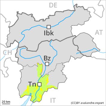
Regions
Prealps, Cembra Valley, Bondone and Stivo, Vallarsa, Western Nonsberg Alps, Folgaria - Laverone, Ledro Valley, Marzola - Valsugana, Pine' - Mocheni Valley
Danger level
Danger Level 2 - Moderate above 1500m
Danger Level 1 - Low above 1500m
Avalanche Problem
Wind-drifted snow above the treeline, N-NE-E-SE-W-NW

In the last few days the wind slabs have increased in size once again. Wind slabs are to be evaluated critically. Even in moderately steep terrain there is a danger of falling on the hard crust.
The avalanche-prone wind slabs can be released easily, even by a single winter sport participant, in all aspects above approximately 1800 m, especially at their margins. They are easy for the trained eye to recognise but to be assessed critically, especially adjacent to ridgelines and in pass areas,, in isolated cases also in gullies and bowls, and behind abrupt changes in the terrain.
Snowpack
dp 6: cold, loose snow and wind
In some localities 2 to 5 cm of snow, and even more in some localities, will fall during the night in all altitude zones. The snowpack will be generally stable. The northerly wind will transport the snow. The fresh and somewhat older wind slabs will form in particular adjacent to ridgelines and in gullies and bowls in all aspects and at elevated altitudes. These can be released in isolated cases in all aspects. In some cases fresh snow and wind slabs are lying on surface hoar. This applies in particular in shady places that are protected from the wind and in areas close to the tree line.
Tendency
Low, level 1.
Regions
Sexten Dolomites, Latemar, Southern Adamello, Adamello - Presanella, Northern Brenta - Peller, Southern Brenta, Southern Lagorai, Northern Lagorai, Grieskogel Mountains, Val Müstair Alps, Langtaufers, Eastern Verwall Mountains, Schnals Ridge, Southern Stubai Alps, Samnaun Mountains, Southern Zillertal Alps and High Tauern, Northern Oetz and Stubai Alps, Saldurn-Mastaun Ridge, Western Tuxer Alps, Texel Mountains, Eastern Tuxer Alps, Sarntal Alps, Western Pfunderer Mountains, Glockturm Range, Maddalene, Eastern Pfunderer Mountains, Durreck Range, Weißkugel Range, Western Rieserferner Mountains, Gurgler Range, Western Deferegger Alps, Central Stubai Alps, Ortler Range, Northern Zillertal Alps, Ulten Valley, Venediger Range, Eastern Nonsberger Alps, Eastern Rieserferner Mountains, Northern Dolomites of Fiemme, Glockner Range, Gröden Dolomites, Primiero - Pale di S. Martino, Eastern Deferegger Alps, Prags Dolomites, Schober Mountains, Lienzer Dolomites, Fassa Valley, Sole, Pejo and Rabbi, Paganella
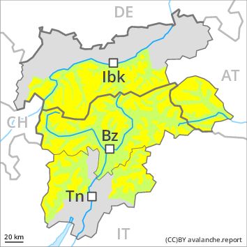
Danger level
Danger Level 2 - Moderate above the treeline
Danger Level 1 - Low above the treeline
Avalanche Problem
Wind-drifted snow above the treeline, N-NE-E-SE-S-NW
Fresh wind slabs represent the main danger.
Slight increase in avalanche danger as a consequence of fresh snow and wind, caution is to be exercised in particular on steep shady slopes as well as adjacent to ridgelines and in gullies and bowls. The number and size of avalanche prone locations will increase with altitude. Avalanches can be released, even by a single winter sport participant and reach medium size. In regions exposed to heavier precipitation avalanche prone locations are more prevalent and the danger is greater. Backcountry touring calls for experience in the assessment of avalanche danger.
Snowpack
dp 6: cold, loose snow and wind
2 to 10 cm of snow, and even more in some localities, will fall, in particular in the west and in the north. The strong wind will transport the fresh and old snow. In some cases wind slabs are lying on soft layers. As the day progresses the wind slabs will increase in size. The old snowpack will be generally well bonded.
Tendency
The avalanche danger will increase, in particular in the west and in the north.