Regions
Sexten Dolomites, Eastern Pfunderer Mountains, Durreck Range, Western Rieserferner Mountains, Val Müstair Alps, Western Deferegger Alps, Langtaufers, Ortler Range, Schnals Ridge, Southern Stubai Alps, Ulten Valley, Southern Zillertal Alps and High Tauern, Eastern Nonsberger Alps, Northern Dolomites of Fiemme, Saldurn-Mastaun Ridge, Gröden Dolomites, Texel Mountains, Prags Dolomites, Sarntal Alps, Western Pfunderer Mountains
AM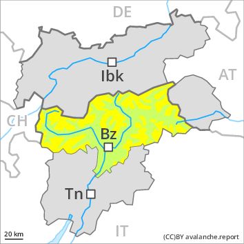
Danger level
Avalanche Problem
Persistent weak layer above 2200m, N-NE-E-NW
PM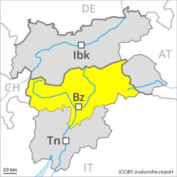
Danger level
Avalanche Problem
Persistent weak layer above 2200m, N-NE-E-SE-S-SW-W-NW
Gliding snow above 2600m, N-NE-E-SE-S-SW-W-NW
The avalanche danger will increase during the day.
The older wind slabs can still be released especially on very steep northwest, north and southeast facing slopes. Caution is to be exercised at their margins in particular, in particular in gullies and bowls, and behind abrupt changes in the terrain. Avalanches can be released in deep layers in particular at transitions from a shallow to a deep snowpack. As a consequence of warming a sometimes precarious avalanche situation will persist. As the moisture increases small and medium-sized wet and gliding avalanches are possible below approximately 2600 m.
Snowpack
Weak layers in the old snowpack are difficult to recognise. The various wind slabs of last week can be released in isolated cases, but mostly only by large additional loads,. They are to be found in particular adjacent to ridgelines and in gullies and bowls and at high altitudes. The various wind slabs have bonded quite well together. In little used backcountry terrain the avalanche situation is a little more dangerous. The old snowpack will become moist below approximately 2000 m.
Tendency
As a consequence of fresh snow and strong wind the prevalence and size of the avalanche prone locations will increase on Saturday. In the regions exposed to snowfall this applies in particular.