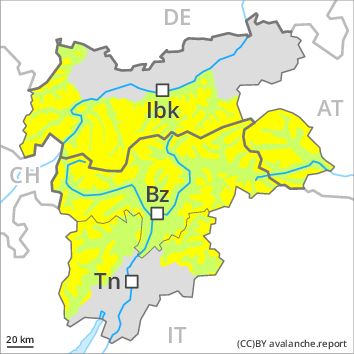
Regions
Sexten Dolomites, Latemar, Southern Adamello, Adamello - Presanella, Northern Brenta - Peller, Southern Brenta, Northern Lagorai, Allgäu Alps, Western Lechtal Alps, Central Lechtal Alps, Val Müstair Alps, Western Verwall Mountains, Langtaufers, Eastern Verwall Mountains, Schnals Ridge, Silvretta, Southern Stubai Alps, Samnaun Mountains, Southern Zillertal Alps and High Tauern, Northern Oetz and Stubai Alps, Saldurn-Mastaun Ridge, Western Tuxer Alps, Texel Mountains, Eastern Tuxer Alps, Sarntal Alps, Western Pfunderer Mountains, Glockturm Range, Maddalene, Eastern Pfunderer Mountains, Durreck Range, Weißkugel Range, Western Rieserferner Mountains, Gurgler Range, Western Deferegger Alps, Central Stubai Alps, Ortler Range, Northern Zillertal Alps, Ulten Valley, Venediger Range, Eastern Nonsberger Alps, Eastern Rieserferner Mountains, Northern Dolomites of Fiemme, Glockner Range, Gröden Dolomites, Primiero - Pale di S. Martino, Eastern Deferegger Alps, Prags Dolomites, Schober Mountains, Lienzer Dolomites, Western Nonsberg Alps, Fassa Valley, Sole, Pejo and Rabbi
Danger level
Avalanche Problem
Wind-drifted snow above the treeline, N-NE-E-SE-NW
![]()
Fresh wind slabs require caution.
As a consequence of fresh snow and strong wind the wind slabs will increase in size as the day progresses. The prevalence of avalanche prone locations and likelihood of triggering will increase in the afternoon. The fresh wind slabs can be released by a single winter sport participant in some cases in particular on steep shady slopes. From origins in starting zones at higher altitudes dry slab avalanches are possible, but they will be mostly small. They can be released in the weakly bonded old snow in particular in areas where the snow cover is rather shallow.
Snowpack
dp 5: snowfall after a long period of cold
Over a wide area 5 to 15 cm of snow, and even more in some localities, will fall until the evening. The strong wind will transport the fresh snow. Especially above the tree line sometimes easily released wind slabs will form. The fresh snow and wind slabs will be deposited on a weakly bonded old snowpack in particular on shady slopes. Faceted weak layers exist in the old snowpack especially here.
Tendency
Wednesday: Further increase in avalanche danger in the regions exposed to precipitation.