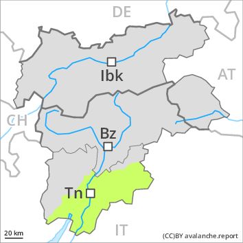
Regions
Sexten Dolomites, Latemar, Western Deferegger Alps, Ulten Valley, Eastern Nonsberger Alps, Northern Dolomites of Fiemme, Gröden Dolomites, Southern Adamello, Eastern Deferegger Alps, Prags Dolomites, Sarntal Alps, Adamello - Presanella, Schober Mountains, Northern Brenta - Peller, Lienzer Dolomites, Western Nonsberg Alps, Southern Brenta, Fassa Valley, Sole, Pejo and Rabbi, Maddalene
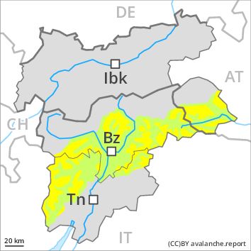
Danger level
Avalanche Problem
Wind-drifted snow above the treeline, N-NE-E-SE-NW
Wet snow above 2600m, SE-S-SW-W
![]()
The danger of dry and wet avalanches will increase a little during the day.
The more recent wind slabs can still be released in particular on steep shady slopes above the tree line. As a consequence of warming during the day small and, in isolated cases, medium-sized moist and wet avalanches are possible. They can be released in the weakly bonded old snow in particular in areas where the snow cover is rather shallow. In particular transitions from a shallow to a deep snowpack where weaknesses exist in the old snowpack are precarious.
Snowpack
The storm force wind will transport the loosely bonded old snow. In particular above the tree line mostly small wind slabs will form. Restraint should be exercised because avalanches can sweep people along and give rise to falls. Large-grained weak layers exist in the snowpack especially on steep, rather lightly snow-covered shady slopes. At high altitudes and in high Alpine regions the avalanche prone locations are more prevalent.
Tendency
The wind will be strong over a wide area. The weather will be cold.