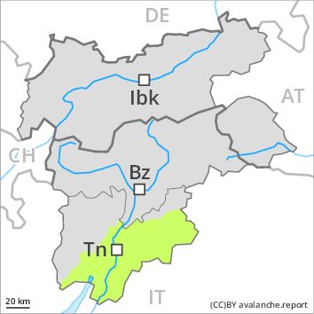
Regions
Sexten Dolomites, Eastern Pfunderer Mountains, Latemar, Western Deferegger Alps, Ulten Valley, Eastern Nonsberger Alps, Northern Dolomites of Fiemme, Gröden Dolomites, Southern Adamello, Eastern Deferegger Alps, Prags Dolomites, Sarntal Alps, Adamello - Presanella, Schober Mountains, Western Pfunderer Mountains, Northern Brenta - Peller, Lienzer Dolomites, Western Nonsberg Alps, Southern Brenta, Fassa Valley, Sole, Pejo and Rabbi, Maddalene
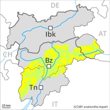
Danger level
Avalanche Problem
Wind-drifted snow above the treeline, N-NE-E-SE-S-SW-W-NW
![]()
Fresh wind slabs above the tree line.
As a consequence of the snowfall, the likelihood of dry avalanches being released will increase a little especially above the tree line. Especially in places where the wind is storm force the avalanche danger is greater. The number and size of avalanche prone locations will increase as the day progresses. The avalanche prone locations are to be found in particular adjacent to ridgelines and in gullies and bowls in all aspects. They will increase with altitude. In the regions neighbouring those that are subject to danger level 3 (considerable) the avalanche danger is higher.
Snowpack
dp 6: cold, loose snow and wind
5 to 15 cm of snow. will fall. The northwesterly wind will transport the snow. As a consequence of fresh snow and a storm force wind from northwesterly directions, brittle wind slabs will form in particular on east, south and southwest facing slopes.
Tendency
The avalanche danger will persist.