Regions
Eastern Pfunderer Mountains, Durreck Range, Weißkugel Range, Western Rieserferner Mountains, Val Müstair Alps, Gurgler Range, Langtaufers, Central Stubai Alps, Schnals Ridge, Northern Zillertal Alps, Southern Stubai Alps, Samnaun Mountains, Southern Zillertal Alps and High Tauern, Northern Oetz and Stubai Alps, Saldurn-Mastaun Ridge, Western Tuxer Alps, Texel Mountains, Eastern Tuxer Alps, Western Pfunderer Mountains, Glockturm Range, Grieskogel Mountains
Danger level
Avalanche Problem
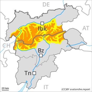
Wind-drifted snow above the treeline, N-NE-E-SE-S-SW-W-NW
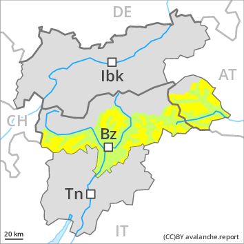
Persistent weak layer above 2900m above 2000m, N-NE-E-W-NW
![]()
The fresh snow and wind slabs of the last few days can be released by a single winter sport participant in all aspects above the tree line.
As a consequence of fresh snow and a strong to storm force wind, extensive wind slabs formed in the last few days in all aspects, caution is to be exercised in particular on very steep shady slopes as well as adjacent to ridgelines and in gullies and bowls especially above the tree line. The wind slabs can be released even by a single winter sport participant.
Weakly bonded old snow requires caution. These avalanche prone locations are to be found in particular on very steep west, north and east facing slopes between approximately 2300 and 2900 m. Caution is to be exercised in particular at transitions from a shallow to a deep snowpack in little used backcountry terrain. Avalanches can be released, in particular by large loads and reach large size in isolated cases. Individual avalanche prone locations are to be found also between approximately 2000 and 2300 m, in particular on very steep shady slopes. The avalanches in these loacations are rather small and can be released by large loads.
Some small and, in isolated cases, medium-sized loose snow avalanches are possible as a consequence of solar radiation.
In addition a certain danger of gliding avalanches exists. This applies on steep grassy slopes below approximately 2500 m.
Snowpack
dp 6: cold, loose snow and wind
dp 4: cold following warm / warm following cold
Over a wide area 10 to 30 cm of snow, and even more in some localities, has fallen in the last three days above approximately 1800 m. The sometimes storm force wind has transported the fresh snow significantly. In some cases the various wind slabs have bonded still only poorly with each other and the old snowpack. This applies in particular above the tree line. Faceted weak layers exist in the old snowpack, in particular between approximately 2300 and 2900 m, especially in little used backcountry terrain, also between approximately 2000 and 2300 m on northwest, north and northeast facing slopes. The snowpack will be subject to considerable local variations.
Tendency
Gradual decrease in avalanche danger.