Regions
Texel Mountains, Western Pfunderer Mountains, Eastern Pfunderer Mountains, Durreck Range, Western Rieserferner Mountains, Val Müstair Alps, Western Deferegger Alps, Langtaufers, Schnals Ridge, Southern Stubai Alps, Southern Zillertal Alps and High Tauern, Saldurn-Mastaun Ridge
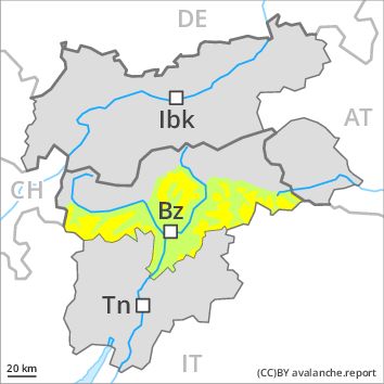
Danger level
Avalanche Problem
Wind-drifted snow above the treeline, N-NE-E-SE-S-SW-W-NW
![]()
Gradual increase in avalanche danger as a consequence of the snowfall.
As a consequence of a moderate wind, further wind slabs will form. They are in some cases prone to triggering. They can be released even by a single winter sport participant in all aspects. This applies in particular at their margins. Mostly the avalanches are medium-sized. In regions with a lot of snow avalanche prone locations are more prevalent and the danger is greater. The avalanche prone locations are sometimes covered with fresh snow and are barely recognisable because of the poor visibility.
Avalanches can also penetrate deep layers and reach dangerously large size.
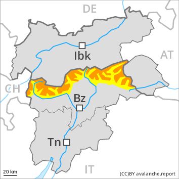
Snowpack
dp 6: cold, loose snow and wind
Some snow will fall over a wide area. As the day progresses the wind slabs will increase in size additionally. In some cases the various wind slabs have bonded still only poorly with each other and the old snowpack. Faceted weak layers exist in the old snowpack. The old snowpack will be in some cases prone to triggering. Distinct weak layers in the lower part of the snowpack can be released in some places.
Tendency
Rapid increase in avalanche danger as the snowfall becomes more intense.