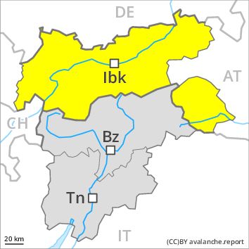
Regions
Western Verwall Mountains, Eastern Verwall Mountains, Silvretta, Samnaun Mountains, Northern Oetz and Stubai Alps, Western Tuxer Alps, Eastern Tuxer Alps, Western Kitzbühel Alps, Eastern Kitzbühel Alps, Glockturm Range, Weißkugel Range, Gurgler Range, Central Stubai Alps, Northern Zillertal Alps, Allgäu Alps, Venediger Range, Eastern Lechtal Alps - Ammergau Alps, Mieming Mountains, Eastern Rieserferner Mountains, Karwendel Mountains, Glockner Range, Eastern Deferegger Alps, Brandenberg Alps, Wilder Kaiser Mountains - Waidring Alps, Schober Mountains, Lienzer Dolomites, Western Lechtal Alps, Central Lechtal Alps, Grieskogel Mountains
Danger level
Avalanche Problem
Wind-drifted snow above 2200m, N-NE-NW
Wet snow above 2200m, N-NE-E-SE-S-SW-W-NW
![]()
Wind slabs at high altitude. Wet and gliding snow require caution.
As a consequence of a moderate to strong wind from southerly directions, mostly small wind slabs will form. The somewhat older wind slabs of the last few days remain in some cases prone to triggering in particular on very steep shady slopes above approximately 2200 m. The fresh and somewhat older wind slabs can be released by a single winter sport participant in some cases. The avalanche prone locations are to be found in particular adjacent to ridgelines and in gullies and bowls in northwest to north to northeast facing aspects. At elevated altitudes the avalanche prone locations are more prevalent. In the regions neighbouring those that are subject to danger level 3 (considerable) and in the regions exposed to heavier precipitation the avalanche danger is higher.
In addition there is a danger of gliding avalanches and moist snow slides. This applies in particular on steep sunny slopes and on steep grassy slopes.
Snowpack
dp 6: cold, loose snow and wind
dp 3: rain
The wind slabs of the last few days have settled a little. Some snow will fall from the afternoon in particular along the border with Vorarlberg and along the border with South Tyrol,, also in the Schober Mountains and in the Glockner Range. The southerly wind will transport the fresh and old snow. Low and intermediate altitudes: Some rain will fall in some localities. The snowpack will be subject to considerable local variations.
Outgoing longwave radiation during the night will be severely restricted over a wide area.
Tendency
Slight increase in avalanche danger as a consequence of the precipitation.