Regions
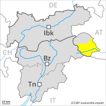
Eastern Deferegger Alps, Schober Mountains, Lienzer Dolomites
Danger level
Danger Level 2 - Moderate
Avalanche Problem
Gliding snow above 2600m, E-SE-S-SW-W
Wind-drifted snow above 2400m, N-NE-E-NW

Gliding snow represents the main danger. Wind slabs are in isolated cases prone to triggering at high altitudes and in high Alpine regions.
Gradual decrease in danger of wet avalanches as the temperature drops. Not yet all gliding avalanches have been released especially on steep grassy slopes. Caution is to be exercised in areas with glide cracks.
As a consequence of a sometimes strong westerly wind, small wind slabs will form as well. These are in isolated cases prone to triggering, especially on very steep shady slopes above approximately 2400 m adjacent to ridgelines. These avalanche prone locations are very rare and are clearly recognisable to the trained eye. The avalanches are only small.
Snowpack
dp 2: gliding snow
dp 6: cold, loose snow and wind
At low altitude no snow is lying. At intermediate altitudes the snow is wet. Outgoing longwave radiation during the night will be reduced. The somewhat older wind slabs have bonded well with the old snowpack in all aspects. Fresh wind slabs require caution.
Tendency
Further decrease in danger of moist avalanches as the temperature drops.
Regions
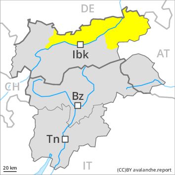
Karwendel Mountains, Brandenberg Alps, Western Kitzbühel Alps, Wilder Kaiser Mountains - Waidring Alps, Eastern Kitzbühel Alps, Mieming Mountains
Danger level
Danger Level 2 - Moderate
Avalanche Problem
Gliding snow above 2600m, E-SE-S-SW-W
Wind-drifted snow above 2400m, N-NE-E-NW
Gliding snow represents the main danger. Wind slabs are in isolated cases prone to triggering at high altitudes and in high Alpine regions.
As a consequence of the rain, the likelihood of wet avalanches being released will increase for a while in all aspects below approximately 2200 m. Gliding avalanches and wet loose snow avalanches require caution. Gradual decrease in danger of wet avalanches as the snowfall level drops. Not yet all gliding avalanches have been released especially on steep grassy slopes. Caution is to be exercised in areas with glide cracks.
As a consequence of fresh snow and a sometimes strong westerly wind, mostly small wind slabs will form as well. These are in isolated cases prone to triggering, especially above approximately 2400 m adjacent to ridgelines. These avalanche prone locations are rather rare and are clearly recognisable to the trained eye. The avalanches are only small.
Snowpack
dp 2: gliding snow
dp 6: cold, loose snow and wind
At low altitude no snow is lying. At intermediate altitudes the snow is wet. Outgoing longwave radiation during the night will be barely evident. The somewhat older wind slabs have bonded well with the old snowpack in all aspects. Fresh wind slabs require caution.
Tendency
Further decrease in danger of moist avalanches as the temperature drops.
Regions
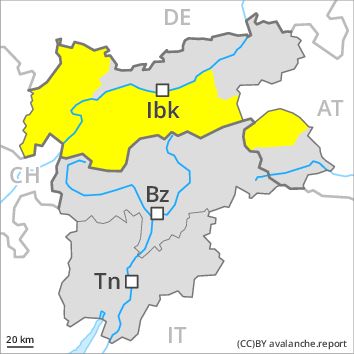
Weißkugel Range, Western Verwall Mountains, Gurgler Range, Central Stubai Alps, Eastern Verwall Mountains, Northern Zillertal Alps, Allgäu Alps, Silvretta, Venediger Range, Samnaun Mountains, Eastern Lechtal Alps - Ammergau Alps, Northern Oetz and Stubai Alps, Eastern Rieserferner Mountains, Western Tuxer Alps, Glockner Range, Eastern Tuxer Alps, Western Lechtal Alps, Central Lechtal Alps, Glockturm Range, Grieskogel Mountains
Danger level
Danger Level 2 - Moderate
Avalanche Problem
Gliding snow above 2600m, E-SE-S-SW-W
Wind-drifted snow above 2400m, N-NE-E-NW
Gliding snow represents the main danger. Wind slabs are in isolated cases prone to triggering at high altitudes and in high Alpine regions.
As a consequence of the rain, the likelihood of wet avalanches being released will increase for a while in all aspects below approximately 2200 m. Gliding avalanches and wet loose snow avalanches require caution. Gradual decrease in danger of wet avalanches as the snowfall level drops. Not yet all gliding avalanches have been released especially on steep grassy slopes. Caution is to be exercised in areas with glide cracks.
As a consequence of fresh snow and a sometimes strong westerly wind, mostly small wind slabs will form as well. These are in isolated cases prone to triggering, especially above approximately 2400 m adjacent to ridgelines. These avalanche prone locations are rather rare and are clearly recognisable to the trained eye. The avalanches are only small.
In addition the no longer entirely fresh wind slabs should be taken into account, in particular on extremely steep shady slopes above approximately 2800 m.
Snowpack
dp 2: gliding snow
dp 6: cold, loose snow and wind
At low altitude no snow is lying. At intermediate altitudes the snow is wet. Outgoing longwave radiation during the night will be barely evident. The more recent wind slabs have bonded well with the old snowpack in all aspects below approximately 2800 m. In some places fresh snow and wind slabs are lying on soft layers. This applies in particular above approximately 2800 m on shady slopes. In very isolated cases weak layers exist in the old snowpack in particular on west, north and northeast facing slopes, especially above approximately 2600 m.
Tendency
Further decrease in danger of moist avalanches as the temperature drops.