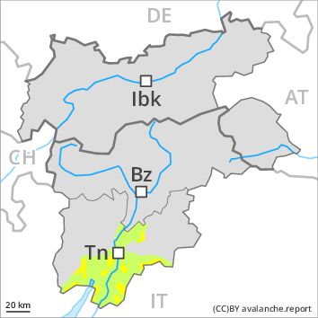
Regions
Latemar, Southern Adamello, Primiero - Pale di S. Martino, Adamello - Presanella, Northern Brenta - Peller, Western Nonsberg Alps, Southern Brenta, Fassa Valley, Sole, Pejo and Rabbi, Southern Lagorai, Northern Lagorai, Maddalene, Paganella, Pine' - Mocheni Valley
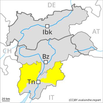
Danger level
Avalanche Problem
Wet snow, N-NE-E-SE-S-SW-W-NW
Persistent weak layer above 2200m, N-NE-NW
![]()
The danger of moist and wet avalanches will decrease gradually, but only during the night.
The danger of wet and gliding avalanches will decrease gradually. Until the temperature drops more avalanches are possible until late in the night, even medium-sized ones. Weak layers exist in the snowpack in particular on wind-loaded slopes. This applies on steep northeast, north and northwest facing slopes above approximately 2200 m adjacent to ridgelines. These avalanche prone locations are difficult to recognise. They can be released in isolated cases, but mostly only by large additional loads, in high Alpine regions. As a consequence of the rain, the likelihood of moist and wet avalanches being released will increase a little in particular on steep slopes at intermediate altitudes.
Snowpack
dp 10: springtime scenario
The older wind slabs have bonded well with the old snowpack. In very isolated cases weak layers exist in the old snowpack on shady slopes, in particular in areas where the snow cover is rather shallow. In some places wind slabs are lying on soft layers, in particular on shady slopes above approximately 2400 m. At low altitude a little snow is lying.
Tendency
Slight decrease in avalanche danger as the snowfall level drops.