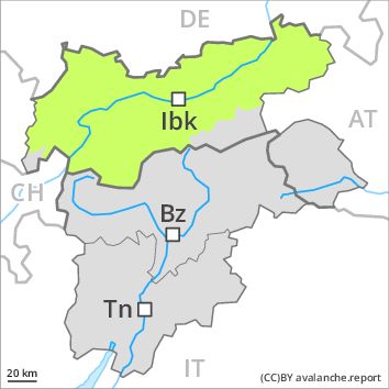
Regions
Sexten Dolomites, Latemar, Southern Stubai Alps, Southern Zillertal Alps and High Tauern, Texel Mountains, Southern Adamello, Sarntal Alps, Adamello - Presanella, Western Pfunderer Mountains, Northern Brenta - Peller, Bondone and Stivo, Folgaria - Laverone, Southern Brenta, Southern Lagorai, Northern Lagorai, Maddalene, Pine' - Mocheni Valley, Eastern Pfunderer Mountains, Durreck Range, Western Rieserferner Mountains, Western Deferegger Alps, Ortler Range, Northern Zillertal Alps, Ulten Valley, Venediger Range, Eastern Nonsberger Alps, Eastern Rieserferner Mountains, Northern Dolomites of Fiemme, Glockner Range, Gröden Dolomites, Primiero - Pale di S. Martino, Eastern Deferegger Alps, Prags Dolomites, Prealps, Schober Mountains, Cembra Valley, Lienzer Dolomites, Vallarsa, Western Nonsberg Alps, Fassa Valley, Sole, Pejo and Rabbi, Ledro Valley, Paganella, Marzola - Valsugana
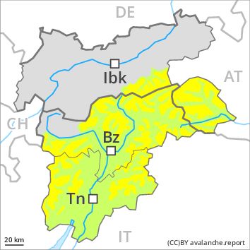
Danger level
Avalanche Problem
Wind-drifted snow above 2200m, E-SE-S-SW-W
![]()
High altitudes and the high Alpine regions: Fresh wind slabs represent the main danger.
The Avalanche Warning Service currently has only a small amount of information that has been collected in the field. As a consequence of fresh snow and a sometimes moderate northeasterly wind, rather small wind slabs will form in places that are protected from the wind. This applies in particular at high altitudes and in high Alpine regions. Mostly the avalanches are rather small but in some cases easily released.
Low and intermediate altitudes: Areas with glide cracks are to be avoided.
Snowpack
dp 6: cold, loose snow and wind
5 to 10 cm of snow, and even more in some localities, will fall above approximately 2000 m. The wind will be moderate to strong for a temporary period. The fresh wind slabs are lying on a crust on east to south to west facing aspects at intermediate and high altitudes. In very isolated cases weak layers exist in the old snowpack.
Outgoing longwave radiation during the night will be severely restricted. At intermediate altitudes the snow is wet. At low altitude no snow is lying.
Tendency
Hardly any decrease in avalanche danger.