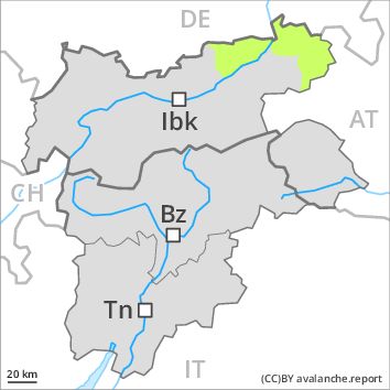
Regions
Western Verwall Mountains, Eastern Verwall Mountains, Silvretta, Samnaun Mountains, Northern Oetz and Stubai Alps, Western Tuxer Alps, Southern Adamello, Eastern Tuxer Alps, Adamello - Presanella, Western Kitzbühel Alps, Northern Brenta - Peller, Glockturm Range, Southern Brenta, Weißkugel Range, Gurgler Range, Central Stubai Alps, Northern Zillertal Alps, Allgäu Alps, Venediger Range, Eastern Lechtal Alps - Ammergau Alps, Mieming Mountains, Eastern Rieserferner Mountains, Karwendel Mountains, Glockner Range, Eastern Deferegger Alps, Schober Mountains, Lienzer Dolomites, Western Lechtal Alps, Central Lechtal Alps, Grieskogel Mountains, Ledro Valley, Paganella
AM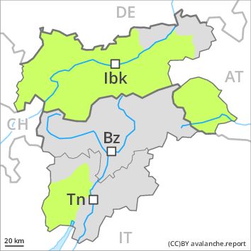
Danger level
PM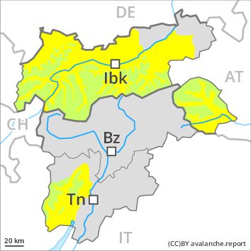
Danger level
Avalanche Problem
Gliding snow above 2600m, E-SE-S-SW-W
Wet snow above 2600m, E-SE-S-SW-W
Gradual increase in avalanche danger as a consequence of warming during the day and solar radiation.
The Avalanche Warning Service currently has only a small amount of information that has been collected in the field.
The avalanche conditions in the morning are favourable.
Midday and afternoon: Gradual increase in avalanche danger as a consequence of warming during the day and solar radiation. Gliding avalanches and wet snow slides are the main danger. The avalanche prone locations are to be found in particular on very steep sunny slopes below approximately 2600 m. These places are rather rare and are easy to recognise.
In addition a low (level 1) danger of dry slab avalanches exists. This applies in particular on extremely steep shady slopes above approximately 2400 m. The avalanches are rather small and can be released by large loads.
Snowpack
dp 2: gliding snow
dp 10: springtime scenario
Outgoing longwave radiation during the night will be quite good. The snowpack will become moist as the day progresses. This applies in particular on sunny slopes.
The somewhat older wind slabs are lying on weak layers in particular on shady slopes at high altitude. Such avalanche prone locations are rare.
The old snowpack will be in most cases stable. At intermediate altitudes hardly any snow is lying. At low altitude no snow is lying.
Tendency
Gradual increase in danger of dry and moist avalanches as a consequence of warming during the day and solar radiation.