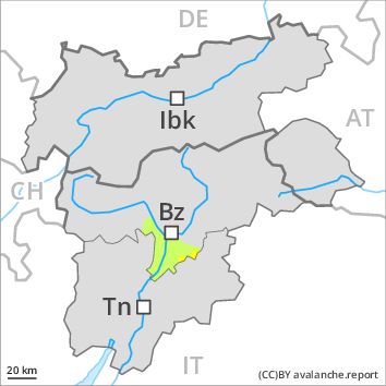
Regions
Eastern Nonsberger Alps, Northern Dolomites of Fiemme
AM

Danger level
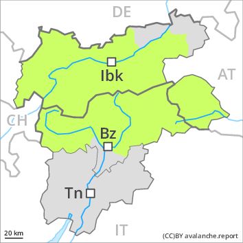
Danger Level 1 - Low above 2200m
Danger Level 1 - Low above 2200m
PM
Danger level
Danger Level 2 - Moderate above 2200m
Danger Level 1 - Low above 2200m
Avalanche Problem
Wet snow above 2800m above 2200m, NE-E-SE-S-SW-W-NW
Gliding snow above 2600m above 2200m, NE-E-SE-S-SW-W-NW
Increase in danger of gliding avalanches and wet snow slides as the day progresses.
The Avalanche Warning Service currently has only a small amount of information that has been collected in the field.
Early and late morning: Low avalanche danger will prevail.
Midday and afternoon: Slight increase in danger of gliding avalanches and wet snow slides as a consequence of warming during the day and solar radiation. The avalanche prone locations are to be found in particular on very steep sunny slopes below approximately 2800 m, but in isolated cases also on extremely steep shady slopes.
In addition a low (level 1) danger of dry slab avalanches exists. This applies in particular on extremely steep shady slopes above approximately 2400 m. The avalanches are only small and can only be released by large loads.
Snowpack
dp 2: gliding snow
dp 10: springtime scenario
A generally clear night. The surface of the snowpack has frozen to form a strong crust and will already soften in the late morning. This applies in particular on sunny slopes.
In very isolated cases weak layers exist in the old snowpack on shady slopes, especially above approximately 2400 m in areas where the snow cover is rather shallow.
Below approximately 1700 m no snow is lying.
Tendency
A mostly overcast night: During the morning as well, individual gliding avalanches and moist snow slides are possible.
Regions
Sexten Dolomites, Val Müstair Alps, Western Verwall Mountains, Langtaufers, Eastern Verwall Mountains, Schnals Ridge, Silvretta, Southern Stubai Alps, Samnaun Mountains, Southern Zillertal Alps and High Tauern, Northern Oetz and Stubai Alps, Saldurn-Mastaun Ridge, Western Tuxer Alps, Texel Mountains, Eastern Tuxer Alps, Sarntal Alps, Western Kitzbühel Alps, Western Pfunderer Mountains, Glockturm Range, Eastern Pfunderer Mountains, Durreck Range, Weißkugel Range, Western Rieserferner Mountains, Gurgler Range, Western Deferegger Alps, Central Stubai Alps, Ortler Range, Northern Zillertal Alps, Allgäu Alps, Ulten Valley, Venediger Range, Eastern Lechtal Alps - Ammergau Alps, Mieming Mountains, Eastern Rieserferner Mountains, Karwendel Mountains, Glockner Range, Gröden Dolomites, Eastern Deferegger Alps, Prags Dolomites, Schober Mountains, Lienzer Dolomites, Western Lechtal Alps, Central Lechtal Alps, Grieskogel Mountains
AM
Danger level
Danger Level 1 - Low above 2800m
Danger Level 1 - Low above 2800m
PM
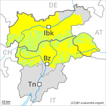
Danger level
Danger Level 1 - Low above 2800m
Danger Level 2 - Moderate above 2800m
Avalanche Problem
Gliding snow above 2600m above 1800m, E-SE-S-SW-W
Wet snow above 2800m, E-SE-S-SW-W
Increase in danger of wet and gliding avalanches as a consequence of warming during the day and solar radiation.
The Avalanche Warning Service currently has only a small amount of information that has been collected in the field.
Early and late morning: Low avalanche danger will prevail.
Midday and afternoon: Slight increase in avalanche danger as a consequence of warming during the day and solar radiation. Gliding avalanches and wet snow slides are the main danger. The avalanche prone locations are to be found in particular on very steep sunny slopes below approximately 2800 m, but in isolated cases also on extremely steep shady slopes below approximately 2200 m.
In addition a low (level 1) danger of dry slab avalanches exists. This applies in particular on extremely steep shady slopes above approximately 2400 m. The avalanches are rather small and can only be released by large loads.
Snowpack
dp 2: gliding snow
dp 10: springtime scenario
A generally clear night. The surface of the snowpack has frozen to form a strong crust and will already soften in the late morning. This applies in particular on sunny slopes.
In very isolated cases weak layers exist in the old snowpack on shady slopes, especially above approximately 2400 m in areas where the snow cover is rather shallow.
At intermediate altitudes hardly any snow is lying. At low altitude no snow is lying.
Tendency
A mostly overcast night: During the morning as well, individual gliding avalanches and moist snow slides are possible.