Regions
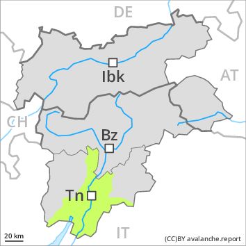
Southern Adamello, Primiero - Pale di S. Martino, Adamello - Presanella, Northern Brenta - Peller, Southern Brenta, Fassa Valley, Sole, Pejo and Rabbi, Southern Lagorai, Northern Lagorai, Latemar, Maddalene
AM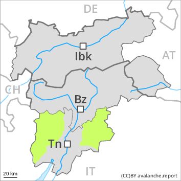
Danger level
PM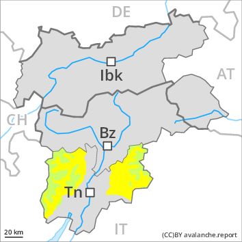
Danger level
Avalanche Problem
Gliding snow above 2600m above 1800m, E-SE-S-SW-W
Wet snow above 2800m, E-SE-S-SW-W
Slight increase in avalanche danger as a consequence of warming during the day and solar radiation. At low and intermediate altitudes only a little snow is lying.
The Avalanche Warning Service currently has only a small amount of information that has been collected in the field. The avalanche conditions in the morning are favourable. Gradual increase in avalanche danger as a consequence of warming during the day and solar radiation. Gliding avalanches and wet snow slides are the main danger. The avalanche prone locations are to be found in particular at the base of rock walls and on steep sunny slopes below approximately 2800 m, but in isolated cases also on shady slopes below approximately 2200 m.
From origins in starting zones where no previous releases have taken place moist and wet avalanches are possible, but they can be large in isolated cases.
Snowpack
dp 10: springtime scenario
The old snowpack will be generally well bonded. The surface of the snowpack will freeze to form a strong crust only at high altitudes and will soften during the day.
In very isolated cases weak layers exist in the old snowpack on shady slopes, especially above approximately 2400 m in areas where the snow cover is rather shallow.
At low and intermediate altitudes only a little snow is lying.
Tendency
A mostly overcast night: The danger of moist and wet avalanches will already increase in the early morning.