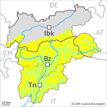
Regions
Sexten Dolomites, Latemar, Southern Adamello, Adamello - Presanella, Northern Brenta - Peller, Bondone and Stivo, Folgaria - Laverone, Southern Brenta, Southern Lagorai, Northern Lagorai, Val Müstair Alps, Langtaufers, Schnals Ridge, Silvretta, Southern Stubai Alps, Samnaun Mountains, Southern Zillertal Alps and High Tauern, Saldurn-Mastaun Ridge, Texel Mountains, Sarntal Alps, Western Pfunderer Mountains, Glockturm Range, Maddalene, Pine' - Mocheni Valley, Eastern Pfunderer Mountains, Durreck Range, Weißkugel Range, Western Rieserferner Mountains, Gurgler Range, Western Deferegger Alps, Central Stubai Alps, Ortler Range, Northern Zillertal Alps, Ulten Valley, Venediger Range, Eastern Nonsberger Alps, Eastern Rieserferner Mountains, Northern Dolomites of Fiemme, Glockner Range, Gröden Dolomites, Primiero - Pale di S. Martino, Eastern Deferegger Alps, Prags Dolomites, Prealps, Schober Mountains, Cembra Valley, Lienzer Dolomites, Vallarsa, Western Nonsberg Alps, Fassa Valley, Sole, Pejo and Rabbi, Ledro Valley, Paganella, Marzola - Valsugana
Danger level
Avalanche Problem
Wet snow above 2800m above 1800m, N-NE-E-SE-S-SW-W-NW
Gliding snow above 2600m above 1800m, N-NE-E-SE-S-SW-W-NW
![]()
In some localities increase in danger of wet and gliding avalanches as a consequence of the rain.
The Avalanche Warning Service currently has only a small amount of information that has been collected in the field.
In some localities increase in danger of wet and gliding avalanches in particular below approximately 2400 m, in the regions exposed to rain especially on steep shady slopes. Isolated avalanche prone locations are to be found on northeast to south to northwest facing aspects between approximately 2000 and 2800 m. Wet avalanches can release the saturated snowpack and can reach as far as areas without any snow cover. From starting zones where no previous releases have taken place avalanches can in isolated cases reach large size.
In some localities increase in danger of dry avalanches as a consequence of fresh snow and wind. This applies in particular on extremely steep shady slopes above approximately 2400 m. Avalanches are rather small and can mostly only be released by large loads.
Snowpack
dp 3: rain
dp 2: gliding snow
In particular in the south rain below approximately 2400 m.
Outgoing longwave radiation during the night will be severely restricted. The surface of the snowpack will freeze very little and will already be soft in the early morning. Individual weak layers exist deep in the old snowpack on shady slopes, especially above approximately 2400 m in areas where the snow cover is rather shallow. At low altitude no snow is lying.
Tendency
The avalanche danger will increase a little during the day.