
Danger level
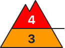 | treeline
|
Avalanche Problem
 | | New snow |
|  | |  |
 | | Persistent weak layer |
| | |  |

Outside marked and open pistes a dangerous avalanche situation will prevail.
As a consequence of new snow and stormy weather numerous natural avalanches are to be expected. This applies in all aspects above the tree line, as well as in areas close to the tree line. Avalanches can be triggered in the faceted old snow and reach quite a large size.
As a consequence of the strong to storm force westerly wind, fresh snow drift accumulations will form, also in areas close to the tree line, as well as below the tree line. These are in some cases quite large. Avalanches can in many places be released very easily and reach dangerously large size. As a consequence of the new snow the avalanche prone locations will become more prevalent as the day progresses.
Great caution and restraint are important.
Snowpack
dp.5: snowfall after a long period of cold
dp.6: cold, loose snow and wind
Over a wide area up to 40 cm of snow, and even more in some localities, has fallen in all altitude zones. Over a wide area 20 cm of snow will fall in the next few hours. The old snowpack is faceted; its surface consists of loosely bonded snow. The westerly wind will transport the new snow and, in some cases, old snow as well. The brittle wind slabs will be deposited on the unfavourable surface of an old snowpack. Faceted weak layers exist in the bottom section of the snowpack at high altitudes and in high Alpine regions.
Tendency
A dangerous avalanche situation will be encountered over a wide area.

Danger level
| treeline
|
Avalanche Problem
| | New snow |
| | | |
| | Persistent weak layer |
| | | |
Outside marked and open pistes a dangerous avalanche situation will prevail.
As a consequence of new snow and stormy weather numerous natural avalanches are to be expected. This applies in all aspects above the tree line, as well as in areas close to the tree line. Avalanches can be triggered in the faceted old snow and reach quite a large size.
As a consequence of the strong to storm force westerly wind, fresh snow drift accumulations will form, also in areas close to the tree line, as well as below the tree line. These are in some cases quite large. Avalanches can in many places be released very easily and reach dangerously large size. As a consequence of the new snow the avalanche prone locations will become more prevalent as the day progresses.
Great caution and restraint are important.
Snowpack
dp.5: snowfall after a long period of cold
dp.6: cold, loose snow and wind
Over a wide area 30 to 50 cm of snow, and even more in some localities, has fallen in all altitude zones. Over a wide area 20 cm of snow will fall in the next few hours. The old snowpack is faceted; its surface consists of loosely bonded snow. The westerly wind will transport the new snow and, in some cases, old snow as well. The brittle wind slabs will be deposited on the unfavourable surface of an old snowpack. Faceted weak layers exist in the bottom section of the snowpack at high altitudes and in high Alpine regions.
Tendency
A dangerous avalanche situation will be encountered over a wide area.

Danger level
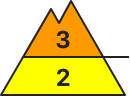 | treeline
|
Avalanche Problem
 | | Wind-drifted snow |
| | | |
| | New snow |
|  | | |
Increase in danger of dry avalanches as a consequence of new snow and strong wind.
The avalanche prone locations for dry avalanches are to be found in particular on steep shady slopes, especially adjacent to ridgelines above the tree line. The avalanche prone locations are quite prevalent. The fresh wind slabs can be released easily by a single winter sport participant.
Snowpack
dp.5: snowfall after a long period of cold
dp.6: cold, loose snow and wind
Over a wide area up to 30 cm of snow has fallen in all altitude zones. Over a wide area 10 cm of snow will fall in the next few hours. The westerly wind will transport the new snow and, in some cases, old snow as well. The brittle wind slabs will be deposited on the unfavourable surface of an old snowpack.
Tendency
Considerable, level 3.
Danger level
| treeline
|
Avalanche Problem
| | Wind-drifted snow |
| | | |
| | Persistent weak layer |
| | | |
Increase in avalanche danger as a consequence of new snow and strong wind. New snow and wind slabs represent the main danger.
The new snow and wind slabs are prone to triggering in all aspects, also below the tree line. As a consequence of new snow and strong wind the wind slabs will increase in size additionally as the day progresses. Avalanches can in many places be released very easily and reach large size in isolated cases. Natural avalanches are possible on wind-loaded slopes. In the regions neighbouring those that are subject to danger level 4 (high) the avalanche danger is higher.
Additionally in isolated cases avalanches can also penetrate deep layers. Remotely triggered avalanches are possible. Especially places where surface hoar has been covered with snow are treacherous. Whumpfing sounds and the formation of shooting cracks when stepping on the snowpack serve as an alarm indicating the danger.
In addition a latent danger of gliding avalanches exists.
Backcountry touring calls for great caution and restraint.
Snowpack
dp.5: snowfall after a long period of cold
dp.8: surface hoar blanketed with snow
In the north and in the northwest 20 to 30 cm of snow, and even more in some localities, will fall until the evening, in particular along the border with Tirol and Begin: South Tyrol. In the southeast a little new snow. The sometimes storm force wind will transport the new snow significantly. The brittle wind slabs will be deposited on unfavourable layers.
Precarious weak layers exist in the top section of the snowpack. As a consequence of low temperatures the snowpack can not consolidate.
Towards its base, the snowpack is well consolidated.
Tendency
The avalanche conditions are to some extent treacherous. Wind slabs are to be evaluated critically.