Danger level
 | treeline
|
Avalanche Problem
 | | Wind-drifted snow |
|  | |  |
 | | Gliding snow |
|  | |  |
 | | Wet snow |
|  | |  |

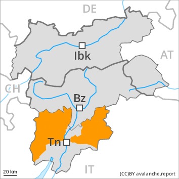
As a consequence of new snow and wind a considerable avalanche danger will persist. The fresh wind slabs can as before be released, even by small loads in isolated cases.
20 to 40 cm of snow has fallen since Saturday above approximately 1800 m. The new snow and wind slabs of the last few days remain for the foreseeable future prone to triggering in all aspects and generally above the tree line, especially on very steep slopes, as well as at transitions from a shallow to a deep snowpack. The avalanches can be released by small loads and reach medium size.
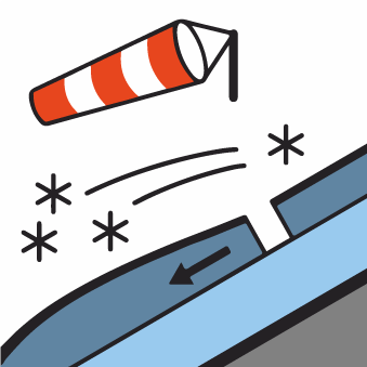
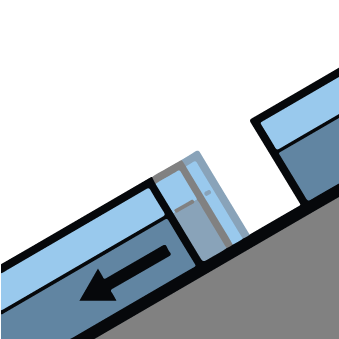
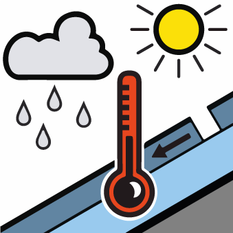
In addition a latent danger of gliding avalanches and moist snow slides exists. As the day progresses individual medium-sized moist slab avalanches are possible. They can also penetrate deep layers and reach quite a large size.
Experience in the assessment of avalanche danger is important. Areas with glide cracks are to be avoided as far as possible.
Snowpack
dp.6: cold, loose snow and wind
dp.3: rain
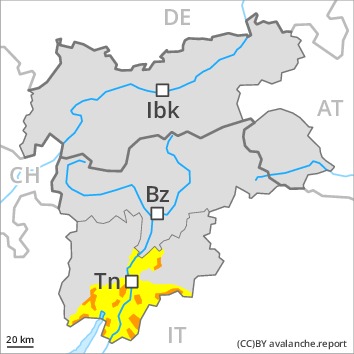
As a consequence of new snow and a strong southwesterly wind, wind slabs formed, in particular adjacent to ridgelines and in gullies and bowls above the tree line. Over a wide area new snow and wind slabs are lying on the smooth surface of an old snowpack, especially above approximately 1900 m.
The old snowpack is moist, in particular in the south, as well as in the other regions in particular at low and intermediate altitudes. Faceted weak layers exist in the centre of the snowpack.
Tendency
Over a wide area 15 to 30 cm of snow will fall on Wednesday above approximately 1000 m. Gradual increase in avalanche danger as the snowfall becomes more intense.

Danger level
 | treeline
|
Avalanche Problem
 | | Wind-drifted snow |
|  | |  |
 | | Wet snow |
|  | |  |
 | | Gliding snow |
|  | |  |

As a consequence of new snow and wind a considerable avalanche danger will persist. The fresh wind slabs can as before be released, even by small loads in isolated cases.
20 to 40 cm of snow has fallen since Saturday above approximately 1800 m. The new snow and wind slabs of the last few days remain for the foreseeable future prone to triggering in all aspects and generally above the tree line, especially on very steep slopes, as well as at transitions from a shallow to a deep snowpack. The avalanches can be released by small loads and reach medium size.
In addition a latent danger of gliding avalanches and moist snow slides exists. As the day progresses individual medium-sized moist slab avalanches are possible. They can also penetrate deep layers and reach quite a large size.
Experience in the assessment of avalanche danger is important. Areas with glide cracks are to be avoided as far as possible.
Snowpack
dp.6: cold, loose snow and wind
dp.3: rain
As a consequence of new snow and a strong southwesterly wind, wind slabs formed, in particular adjacent to ridgelines and in gullies and bowls above the tree line. Over a wide area new snow and wind slabs are lying on the smooth surface of an old snowpack, especially above approximately 1900 m.
The old snowpack is moist, in particular in the south, as well as in the other regions in particular at low and intermediate altitudes. Faceted weak layers exist in the centre of the snowpack.
Tendency
Over a wide area 15 to 30 cm of snow will fall on Wednesday above approximately 1000 m. Gradual increase in avalanche danger as the snowfall becomes more intense.
