By the evening as a consequence of new snow and strong wind there will be an increase in the avalanche danger to level 4 (high). Outside marked and open pistes a precarious avalanche situation will prevail.
As a consequence of new snow and strong wind natural avalanches are to be expected from midday, even large ones in isolated cases. This applies in particular on steep shady slopes in areas close to the tree line, as well as above the tree line. Dry avalanches can additionally be released in the weakly bonded old snow, even by a single winter sport participant, especially on steep shady slopes in areas close to the tree line, as well as above the tree line, also on steep sunny slopes at elevated altitudes. Remotely triggered avalanches are possible in isolated cases. In the regions exposed to heavier precipitation the avalanche prone locations are more prevalent and larger. They are currently prevalent immediately adjacent to the pistes as well. These avalanche prone locations are barely recognisable, even to the trained eye. In all aspects the wind slabs will increase in size once again. These are to be assessed critically. In addition in the regions exposed to heavier precipitation, gliding avalanches are to be expected, especially on steep grassy slopes below approximately 2200 m. Extensive experience in the assessment of avalanche danger and great restraint are important.
Snowpack
dp.5: snowfall after a long period of cold dp.6: cold, loose snow and wind
Over a wide area 15 to 30 cm of snow, and even more in some localities, will fall on Wednesday in all altitude zones. The sometimes storm force wind will transport the fresh and old snow significantly. The fresh snow and the extensive wind slabs will be deposited on the unfavourable surface of an old snowpack in all aspects above the tree line. The fresh wind slabs are very prone to triggering in all aspects. Faceted weak layers exist in the centre of the snowpack, in particular on shady slopes in areas close to the tree line, as well as above the tree line, also on steep sunny slopes at elevated altitudes. Whumpfing sounds and the formation of shooting cracks when stepping on the snowpack indicate the unfavourable bonding of the snowpack.
Tendency
As a consequence of low temperatures and the strong to storm force northerly wind, the snowpack can not consolidate. The snowpack remains prone to triggering, in particular at elevated altitudes, as well as on shady slopes.
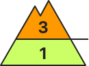
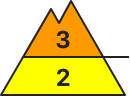
AM Danger level
treeline
Avalanche Problem
Persistent weak layer
Treeline
Wind-drifted snow
Treeline
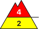
PM Danger level
treeline
Avalanche Problem
Wind-drifted snow
Treeline
Persistent weak layer
Treeline
Gliding snow
2200m
By the evening as a consequence of new snow and strong wind there will be an increase in the avalanche danger. Outside marked and open pistes a sometimes precarious avalanche situation will prevail.
As a consequence of new snow and strong wind natural avalanches are possible from midday. This applies in particular on steep shady slopes in areas close to the tree line, as well as above the tree line. Dry avalanches can additionally be released in the weakly bonded old snow, even by a single winter sport participant, especially on steep shady slopes in areas close to the tree line, as well as above the tree line, also on steep sunny slopes at elevated altitudes. Remotely triggered avalanches are possible in isolated cases. In the regions exposed to heavier precipitation the avalanche prone locations are more prevalent and larger. They are currently prevalent immediately adjacent to the pistes as well. These avalanche prone locations are barely recognisable, even to the trained eye. In all aspects the wind slabs will increase in size once again. They are to be assessed critically. In addition in the regions exposed to heavier precipitation, gliding avalanches are to be expected, especially on steep grassy slopes below approximately 2200 m. Extensive experience in the assessment of avalanche danger and great restraint are important.
Snowpack
dp.5: snowfall after a long period of cold dp.6: cold, loose snow and wind
Over a wide area 15 to 25 cm of snow, and even more in some localities, will fall on Wednesday in all altitude zones. The sometimes storm force wind will transport the fresh and old snow significantly. The fresh snow and the extensive wind slabs will be deposited on the unfavourable surface of an old snowpack in all aspects above the tree line. The fresh wind slabs remain for the foreseeable future prone to triggering, especially at elevated altitudes. Faceted weak layers exist in the centre of the snowpack, in particular on shady slopes in areas close to the tree line, as well as above the tree line, also on steep sunny slopes at elevated altitudes. Whumpfing sounds and the formation of shooting cracks when stepping on the snowpack indicate the unfavourable bonding of the snowpack.
Tendency
As a consequence of low temperatures and the strong to storm force northerly wind, the snowpack can not consolidate. The snowpack remains prone to triggering, in particular at elevated altitudes, as well as on shady slopes.