In some regions increase in danger of dry and wet avalanches as a consequence of the precipitation. Fresh wind slabs require caution. Wet and gliding avalanches below approximately 2400 m.
In the late morning a quite favourable avalanche situation will still be encountered. In the afternoon as a consequence of new snow and wind there will be a gradual increase in the avalanche danger. As a consequence of a strong to storm force wind from northwesterly directions, mostly small wind slabs will form at high altitudes and in high Alpine regions. Avalanches can be released, even by a single winter sport participant and reach medium size. The avalanche-prone wind slabs are to be avoided in particular in steep terrain. As a consequence of new snow and wind the prevalence and size of such avalanche prone locations will increase from midday. As the snowfall level rises wet and gliding avalanches are to be expected during the course of the night, especially on west, north and east facing slopes below approximately 2400 m. Wet avalanches can in isolated cases release the saturated snowpack and reach medium size.
Snowpack
dp.6: cold, loose snow and wind dp.3: rain
As a consequence of snowfall above approximately 2400 m and the storm force westerly wind, fresh snow drift accumulations will form. The sometimes storm force wind will transport the new snow and, in some cases, old snow as well. The new snow and wind slabs are in some cases prone to triggering. The rain will give rise in the afternoon to increasing and thorough wetting of the snowpack over a wide area below approximately 2400 m. These weather conditions will cause a rapid weakening of the weak layers during the course of the night, in particular on west, north and east facing slopes. On sunny slopes below approximately 2200 m only a little snow is lying.
Tendency
The danger of dry avalanches will persist. As a consequence of the strong wind the wind slabs will increase in size additionally on Thursday. As a consequence of warming more wet and gliding avalanches are possible.
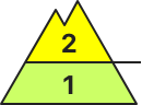
AM Danger level
2200m
Avalanche Problem
Wind-drifted snow
2200m
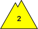
PM Danger level
2200m
Avalanche Problem
Wind-drifted snow
2200m
Wet snow
2200m
Fresh wind slabs require caution.
In the late morning a quite favourable avalanche situation will still be encountered. In the afternoon as a consequence of new snow and wind there will be a gradual increase in the avalanche danger. As a consequence of a strong to storm force wind from northwesterly directions, mostly small wind slabs will form at high altitudes and in high Alpine regions. Avalanches can be released, even by a single winter sport participant and reach medium size. The avalanche-prone wind slabs are to be avoided in particular in steep terrain. During the course of the night as a consequence of warming there will be only a slight increase in the danger of wet and gliding avalanches, especially on west, north and east facing slopes below approximately 2200 m.
Snowpack
dp.6: cold, loose snow and wind dp.3: rain
Some new snow above approximately 2200 m. As a consequence of snowfall and the storm force westerly wind, fresh snow drift accumulations will form. The fresh wind slabs are in some cases prone to triggering. The rain will give rise in the afternoon to increasing softening of the snowpack below approximately 2200 m, in particular on west, north and east facing slopes. On sunny slopes below approximately 2200 m only a little snow is now lying.
Tendency
The danger of dry avalanches will persist. As a consequence of the strong wind the wind slabs will increase in size additionally on Thursday. As a consequence of warming more wet and gliding avalanches are possible.
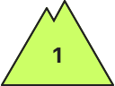
AM Danger level
2200m
Avalanche Problem
Persistent weak layer
2200m
PM Danger level
Avalanche Problem
Wet snow
Persistent weak layer
2200m
A generally favourable avalanche situation will prevail. Weakly bonded old snow requires caution. Slight increase in danger of wet and gliding avalanches as a consequence of warming.
Avalanches can in very isolated cases be released in the weakly bonded old snow, mostly by large additional loads, especially on very steep shady slopes above approximately 2200 m, as well as in gullies and bowls at elevated altitudes. In particular transitions from a shallow to a deep snowpack are unfavourable. The avalanche prone locations are rare but are barely recognisable, even to the trained eye. Snow slides and moist small and medium sized avalanches are possible from the afternoon.
Snowpack
Faceted weak layers exist in the centre of the snowpack, in particular on shady slopes above approximately 2200 m. The snowpack will be generally subject to considerable local variations. Above the tree line snow depths vary greatly, depending on the infuence of the wind. The old snowpack consists of faceted crystals; its surface is loosely bonded and consists of surface hoar and faceted crystals. This applies in particular on shady slopes above the tree line. As a consequence of mild temperatures and solar radiation a crust formed on the surface. On sunny slopes below approximately 2000 m only a little snow is now lying.
Tendency
Over a wide area further warming: Gradual increase in danger of wet and gliding avalanches in particular on shady slopes.