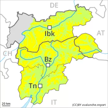
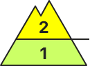
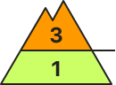
As the day progresses as a consequence of new snow and strong wind there will be an increase in the avalanche danger to level 3 (considerable).
New snow and wind slabs represent the main danger. As a consequence of new snow and a sometimes strong wind from variable directions, sometimes avalanche prone wind slabs will form in particular above the tree line. Avalanche prone locations for dry avalanches are to be found adjacent to ridgelines in all aspects and in gullies and bowls, and behind abrupt changes in the terrain. Avalanches can be released, even by a single winter sport participant and reach medium size. The number and size of avalanche prone locations will increase with altitude. Dry avalanches can additionally in very isolated cases be released in deep layers by large loads. This applies in particular on extremely steep shady slopes above approximately 2400 m in areas where the snow cover is rather shallow.
Snowpack
dp.6: cold, loose snow and wind
Over a wide area 15 to 30 cm of snow, and even more in some localities, will fall on Wednesday. The wind will be strong. In some cases the various wind slabs have bonded poorly together. The old snowpack will be subject to considerable local variations. In very isolated cases weak layers exist in the centre of the old snowpack in particular on shady slopes. This applies in particular above approximately 2400 m.
Tendency
The avalanche danger will persist. Fresh wind slabs require caution.