Distinct weak layers in the old snowpack are treacherous. Fresh wind slabs are to be evaluated with care and prudence.
Distinct weak layers in the old snowpack can still be released by individual winter sport participants in particular on west, north and east facing slopes. This applies in particular in particular above the tree line, and below approximately 2600 m. Caution is to be exercised in particular at transitions from a shallow to a deep snowpack, when entering gullies and bowls for example. Avalanches can reach large size.
As a consequence of a strong wind, sometimes easily released wind slabs formed in the last few days. The clearly visible wind slabs are in some cases still prone to triggering in particular on northwest to north to east facing aspects. These are to be bypassed as far as possible. The avalanche prone locations are to be found in particular on very steep shady slopes above approximately 2200 m.
In addition a latent danger of gliding avalanches exists.
Snowpack
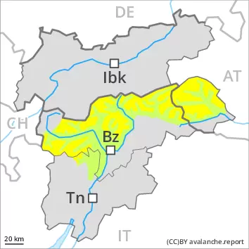
dp.7: snow-poor zones in snow-rich surrounding dp.6: cold, loose snow and wind
Faceted weak layers exist in the centre of the snowpack, especially on west, north and east facing slopes above the tree line, and below approximately 2600 m. The strong wind has transported the fresh and old snow. The fresh and older wind slabs are poorly bonded with the old snowpack in particular on shady slopes and generally at elevated altitudes. The rain gave rise on Thursday to significant moistening of the snowpack over a wide area below approximately 2400 m. As a consequence of falling temperatures a crust formed on the surface.
Tendency
On Monday as a consequence of new snow and strong wind there will be an increase in the avalanche danger.
Danger level
2200m
Avalanche Problem
Wind-drifted snow
2200m
Persistent weak layer
2200m
Fresh wind slabs are to be evaluated with care and prudence. Weak layers in the old snowpack necessitate caution.
As a consequence of a strong wind, sometimes easily released wind slabs formed in the last few days. The clearly visible wind slabs are in some cases still prone to triggering in particular on northwest to north to east facing aspects. They are to be bypassed as far as possible. The avalanche prone locations are to be found in particular on very steep shady slopes above approximately 2200 m and adjacent to ridgelines and in gullies and bowls. At elevated altitudes such avalanche prone locations are more prevalent and larger. Avalanches can reach medium size.
In very isolated cases dry avalanches can also be triggered in the old snowpack, especially on very steep shady slopes at transitions from a shallow to a deep snowpack, this applies in particular in case of a large load, caution is to be exercised in particular in little used terrain, as well as in areas where the snow cover is rather shallow, especially in the north and in the northwest.
Snowpack
dp.6: cold, loose snow and wind dp.7: snow-poor zones in snow-rich surrounding
The strong wind has transported the fresh and old snow. The fresh and older wind slabs are bonding only slowly with the old snowpack in particular on shady slopes at elevated altitudes. They are mostly rather small but in some cases prone to triggering. In its middle, the snowpack is faceted and weak. This applies on shady slopes above approximately 2200 m. The high temperatures on Friday gave rise to significant moistening of the snowpack. This applies on steep sunny slopes in all altitude zones, as well as in all aspects at low and intermediate altitudes. As a consequence of low temperatures a crust formed on the surface.
Tendency
On Monday as a consequence of new snow and strong wind there will be a gradual increase in the avalanche danger. This applies in particular on the Main Alpine Ridge and in Sand in Taufers.
Danger level
2200m
Avalanche Problem
Wind-drifted snow
2200m
Wind slabs are to be evaluated with care and prudence.
As a consequence of a storm force wind, extensive wind slabs formed in the last few days in all aspects. These are in some cases still prone to triggering in particular on steep northwest, north and east facing slopes. The avalanche prone locations are to be found in particular in steep terrain above approximately 2200 m and adjacent to ridgelines and in gullies and bowls. The prevalence of these avalanche prone locations will increase with altitude. Single persons can release avalanches in some places, including medium-sized ones. The fresh wind slabs are to be bypassed in particular in very steep terrain.
Snowpack
dp.6: cold, loose snow and wind
The storm force wind has transported the fresh and old snow significantly. Above approximately 2200 m snow depths vary greatly, depending on the infuence of the wind. The fresh wind slabs are bonding poorly with the old snowpack in particular on shady slopes and generally at elevated altitudes. In some cases the various wind slabs have bonded still only poorly together. The old snowpack consists of faceted crystals, especially on shady slopes. Steep sunny slopes as well as low and intermediate altitudes: The snowpack is moist. As a consequence of falling temperatures a crust will form on the surface.
Tendency
As a consequence of new snow and a strong wind, further wind slabs will form.