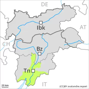
Danger level
 | treeline |
|  |
|  |

![]()
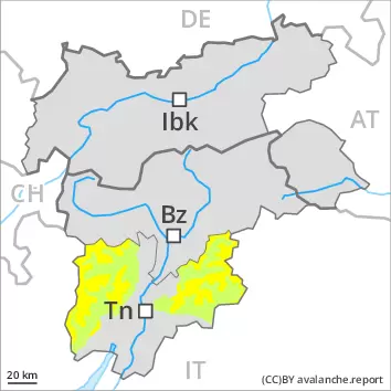
In some localities wind and new snow: Wind slabs are in some cases rather small but to be assessed with care and prudence.
As a consequence of new snow and a storm force northerly wind, further wind slabs will form from late morning. The fresh wind slabs can be released easily in some places in particular on steep shady slopes above approximately 2000 m. They are to be avoided in steep terrain. The avalanche prone locations are to be found especially adjacent to ridgelines and in gullies and bowls above approximately 2000 m. At elevated altitudes the avalanche prone locations are more prevalent and exist in all aspects.
Until the early morning only isolated wet avalanches are to be expected, in the regions exposed to rain especially. As the temperature drops there will be a rapid decrease in the danger of wet avalanches.
Snowpack
dp.6: cold, loose snow and wind
In some localities 5 to 10 cm of snow, and even more in some localities, will fall until late morning above approximately 2000 m. In some regions rain to below 2000 m. Here the snowpack is moist. As a consequence of falling temperatures a crust will form on the surface.
From late morning the wind will be strong to storm force over a wide area. The small quantity of fresh snow and the wind slabs that are being formed by the strong to storm force northerly wind will be deposited on soft layers in particular on steep shady slopes above approximately 2400 m.
Tendency
Fresh wind slabs are to be evaluated with care and prudence. As a consequence of low temperatures, partly cloudy skies and the occasionally strong northerly wind, the snowpack can not consolidate on Sunday.