The backcountry touring conditions are spring-like.
The early morning will see quite favourable conditions mostly. As a consequence of warming during the day and solar radiation there will be only a slight increase in the danger of wet avalanches. This applies in particular on west, south and east facing slopes at high altitude, as well as on shady slopes below approximately 2200 m. Backcountry tours should be concluded timely.
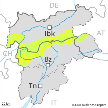
Snowpack
dp.10: springtime scenario
During the night the weather will be clear over a wide area. The surface of the snowpack will freeze to form a strong crust and will soften during the day. The spring-like weather conditions as the day progresses will give rise to a loss of strength within the snowpack. This applies on steep sunny slopes, as well as on shady slopes below approximately 2200 m.
Individual weak layers exist in the top section of the snowpack on steep northwest, north and northeast facing slopes. This applies in particular above approximately 2600 m. Towards its base, the snowpack is well consolidated. Only a little snow is now lying.
Tendency
The backcountry touring conditions are favourable.
AM Danger level
PM Danger level
2400m
Avalanche Problem
Wet snow
2400m
As a consequence of warming and solar radiation a moderate danger of wet avalanches will prevail.
As a consequence of warming during the day and solar radiation more small and medium-sized wet snow slides and avalanches are possible below approximately 2400 m. Restraint should be exercised because avalanches can sweep people along and give rise to falls. In addition a certain danger of gliding avalanches exists, especially on steep grassy slopes in the regions with a lot of snow.
Dry avalanches can in very isolated cases be released by a single winter sport participant. The avalanche prone locations are to be found in particular on very steep northwest, north and northeast facing slopes above approximately 2600 m. Bases of rock walls are especially unfavourable.
Snowpack
dp.10: springtime scenario
Over a wide area a partly clear night. The solar radiation will give rise as the day progresses to softening of the snowpack below approximately 2400 m.
Avalanche prone weak layers exist in the top section of the snowpack at high altitudes and in high Alpine regions. This applies in particular on steep northwest, north and northeast facing slopes above approximately 2600 m. Towards its base, the snowpack is well consolidated.
At low and intermediate altitudes only a little snow is now lying.
Tendency
The conditions in the morning are mostly favourable. Slight increase in avalanche danger as a consequence of warming during the day and solar radiation.
Danger level
The conditions are spring-like.
The early morning will see favourable conditions generally. As a consequence of warming during the day and solar radiation moist snow slides are possible.
Snowpack
dp.10: springtime scenario
In all aspects as well as in all altitude zones only a little snow is now lying. The surface of the snowpack will freeze to form a strong crust only at high altitudes and will soften during the day.