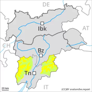
Weakly bonded old snow is to be evaluated with care and prudence.
In isolated cases avalanches can be triggered in the weakly bonded old snow and reach medium size. The avalanche prone locations are to be found in particular on steep west to north to east facing slopes above approximately 2400 m and on steep sunny slopes above approximately 2600 m. Caution is to be exercised at transitions from a shallow to a deep snowpack, and at transitions into gullies and bowls. Older wind slabs are mostly small and can be released by large loads in particular, especially adjacent to ridgelines and in pass areas on very steep shady slopes above approximately 2600 m. The prevalence of the avalanche prone locations will increase with altitude. As a consequence of warming during the day and solar radiation individual gliding avalanches and moist snow slides are possible, but they will be mostly small, especially on steep sunny slopes below approximately 2400 m.
Snowpack
dp.1: deep persistent weak layer dp.10: springtime scenario
Towards its base, the snowpack is faceted, especially on steep west, north and east facing slopes above approximately 2000 m, as well as on steep sunny slopes at elevated altitudes. The fresh and older wind slabs are lying on weak layers in particular on shady slopes at elevated altitudes. Towards its surface, the snowpack is hard and its surface has a melt-freeze crust that is strong in many cases. This applies in particular below approximately 2400 m on steep sunny slopes. The snowpack will be moist at low and intermediate altitudes.
Tendency
The avalanche danger will persist.
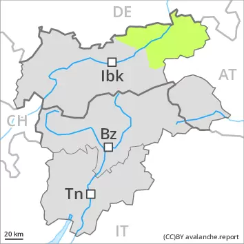
Danger level
2400m
Avalanche Problem
Persistent weak layer
2400m
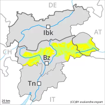
Weakly bonded old snow is to be evaluated with care and prudence.
In some places avalanches can be triggered in the weakly bonded old snow and reach medium size in isolated cases. The avalanche prone locations are to be found in particular on steep west to north to east facing slopes above approximately 2400 m and on steep sunny slopes above approximately 2600 m. Caution is to be exercised at transitions from a shallow to a deep snowpack. The prevalence of the avalanche prone locations will increase with altitude. The fresh wind slabs are mostly small but can be released in isolated cases. Caution is to be exercised in particular on steep shady slopes at elevated altitudes. There is a danger of falling on the hard snow surface.
Snowpack
dp.1: deep persistent weak layer
Towards its base, the snowpack is faceted, especially on steep west, north and east facing slopes above approximately 2400 m, as well as on steep sunny slopes at elevated altitudes. The northwesterly wind will transport the loosely bonded old snow. The fresh wind slabs are lying on soft layers in particular on shady slopes. Towards its surface, the snowpack is hard and its surface has a melt-freeze crust. This applies in particular on steep sunny slopes.
Tendency
On Friday it will be very mild. The wind will be moderate to strong. The old snowpack remains prone to triggering in some places.
Danger level
2400m
Avalanche Problem
Persistent weak layer
2400m
Wind slab
2400m
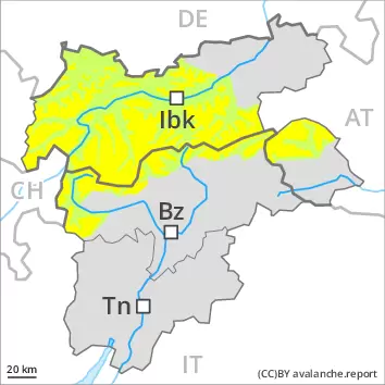
Weakly bonded old snow is to be evaluated with care and prudence. Fresh wind slabs require caution.
In some places avalanches can be triggered in the weakly bonded old snow and reach medium size in isolated cases. The avalanche prone locations are to be found in particular on steep west to north to east facing slopes above approximately 2400 m and on steep sunny slopes above approximately 2600 m. Caution is to be exercised at transitions from a shallow to a deep snowpack. The prevalence of the avalanche prone locations will increase with altitude. Fresh wind slabs are mostly rather small but in some cases prone to triggering. Caution is to be exercised in particular on steep shady slopes at elevated altitudes, and in the regions exposed to heavier precipitation.
Snowpack
dp.1: deep persistent weak layer dp.6: cold, loose snow and wind
Towards its base, the snowpack is faceted, especially on steep west, north and east facing slopes above approximately 2400 m, as well as on steep sunny slopes at elevated altitudes. In some regions up to 10 cm of snow, and even more in some localities, will fall above approximately 1800 m. The westerly wind will transport the new snow and, in some cases, old snow as well. The various wind slabs are lying on soft layers in particular on shady slopes.
Tendency
On Friday it will be very mild. The wind will be moderate to strong. The old snowpack remains prone to triggering in some places.
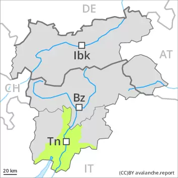
Danger level
Low avalanche danger will prevail.
In very isolated cases avalanches can be triggered in the weakly bonded old snow. The avalanche prone locations are to be found in particular on steep west to north to east facing slopes. Fresh wind slabs are mostly rather small and can be released in isolated cases. Caution is to be exercised in particular on steep shady slopes at elevated altitudes. As a consequence of warming during the day and solar radiation individual moist snow slides are possible. Mostly the avalanches are small.
Snowpack
Over a wide area a little snow is lying. Below approximately 1800 m from a snow sport perspective, in most cases insufficient snow is lying. Towards its base, the snowpack is faceted, especially on steep west, north and east facing slopes. Towards its surface, the snowpack is hard and its surface has a melt-freeze crust that is not capable of bearing a load. Low avalanche danger will prevail.
Tendency
On Friday it will be very mild. The wind will be moderate to strong. The avalanche danger will persist.
Danger level
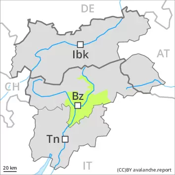
Wind slabs are to be avoided. There is a danger of falling on the hard snow surface.
As a consequence of a moderate to strong wind from westerly directions, small wind slabs will form adjacent to ridgelines. Winter sport participants can release avalanches now only rarely. As the penetration by moisture increases individual gliding avalanches and moist snow slides are possible. This applies especially on steep grassy slopes.
Snowpack
dp.2: gliding snow
The fresh wind slabs are lying on soft layers in particular on steep shady slopes above approximately 2000 m. The old snowpack will be moist. This applies in all aspects at low and intermediate altitudes. A little snow is lying.
Tendency
On Friday it will be very mild. The wind will be moderate to strong. A widespread favourable avalanche situation will prevail.
Danger level
Low avalanche danger will prevail.
In very isolated cases avalanches can be triggered in the weakly bonded old snow. The avalanche prone locations are to be found in particular on steep west to north to east facing slopes. As a consequence of warming during the day and solar radiation individual moist snow slides are possible. Mostly the avalanches are small.
Snowpack
dp.10: springtime scenario
Over a wide area a little snow is lying. Below approximately 1800 m from a snow sport perspective, in most cases insufficient snow is lying. Towards its base, the snowpack is faceted, especially on steep west, north and east facing slopes. Towards its surface, the snowpack is hard and its surface has a melt-freeze crust that is not capable of bearing a load. Low avalanche danger will prevail.