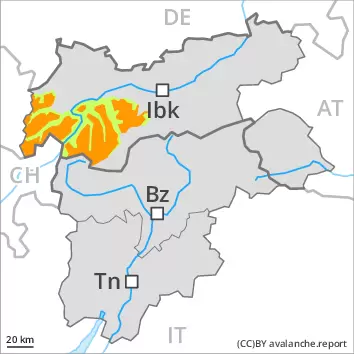
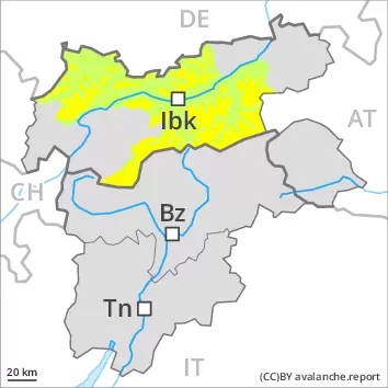
Significant increase in danger of wet avalanches in the course of the day. Weakly bonded old snow is to be evaluated critically.
Weak layers in the old snowpack can be released even now easily by individual winter sport participants. This applies in particular on very steep shady slopes above approximately 2200 m, as well as on very steep east facing slopes above approximately 2400 m. Caution is to be exercised in particular on little used northeast and east facing slopes. Caution is to be exercised at transitions from a shallow to a deep snowpack.
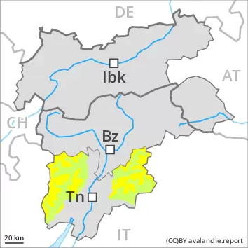
As a consequence of warming during the day and the solar radiation, the likelihood of wet avalanches during the day being released will increase significantly. This applies especially on steep southeast, south and west facing slopes below approximately 2600 m. In particular in steep rocky terrain more small to medium-sized loose snow avalanches are to be expected. In addition an increasing number of gliding avalanches are possible. Backcountry tours should be concluded timely.
Snowpack
dp.10: springtime scenario dp.1: deep persistent weak layer
The weather was very mild over a wide area. The wind slabs have bonded quite well together. Faceted weak layers exist in the old snowpack, especially on shady slopes above approximately 2200 m, as well as on east and west facing slopes above approximately 2400 m. The surface of the snowpack has frozen to form a strong crust and will soften during the day. Sunshine and high temperatures will give rise as the day progresses to increasing softening of the snowpack. The spring-like weather conditions will give rise to a loss of strength within the snowpack in particular on steep west facing slopes below approximately 2600 m. Only a small amount of snow is lying for the time of year at low and intermediate altitudes.
Tendency
Sunday: Slight decrease in danger of wet and gliding avalanches.
AM Danger level
2200m
Avalanche Problem
Persistent weak layer
2200m
Wind slab
2600m
PM Danger level
2600m
Avalanche Problem
Wet snow
2600m
Persistent weak layer
2200m
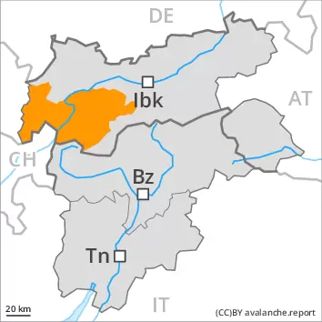
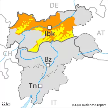
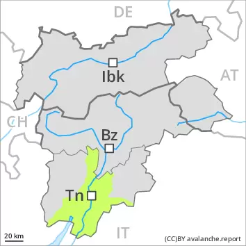
Weakly bonded old snow represents the main danger. Wet avalanches as the day progresses.
Even single persons can release avalanches easily, especially on very steep shady slopes above approximately 2200 m, as well as on very steep east and west facing slopes above approximately 2400 m. The avalanches can be released in the weakly bonded old snow and reach medium size. Caution is to be exercised at transitions from a shallow to a deep snowpack. As the day progresses the likelihood of avalanches being released will increase a little. In addition the somewhat older wind slabs are capable of being triggered in some cases still.
As a consequence of warming during the day and the solar radiation, the likelihood of wet avalanches being released will increase, in particular on sunny slopes below approximately 2600 m. Backcountry tours should be concluded timely.
Snowpack
dp.1: deep persistent weak layer dp.10: springtime scenario
Faceted weak layers exist in the old snowpack, especially on shady slopes above approximately 2200 m, as well as on east and west facing slopes above approximately 2400 m. The wind slabs are in some cases still prone to triggering at high altitudes and in high Alpine regions. Released avalanches and field observations confirm this situation.
Sunshine and high temperatures will give rise as the day progresses to increasing moistening of the snowpack. These conditions will bring about a gradual weakening of the snowpack.
Tendency
Sunday: Slight decrease in danger of wet and gliding avalanches as the temperature drops.
AM Danger level
2200m
Avalanche Problem
Persistent weak layer
2200m
PM Danger level
2600m
Avalanche Problem
Wet snow
2600m
Persistent weak layer
2200m
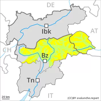
Significant increase in danger of wet avalanches in the course of the day.
Weak layers in the old snowpack can be released even now by individual winter sport participants. This applies in particular on very steep shady slopes above approximately 2200 m, as well as on very steep east facing slopes above approximately 2400 m. Caution is to be exercised at transitions from a shallow to a deep snowpack.
As a consequence of warming during the day and the solar radiation, the likelihood of wet avalanches during the day being released will increase significantly. This applies especially on steep southeast, south and west facing slopes below approximately 2600 m. In particular in steep rocky terrain more small to medium-sized loose snow avalanches are to be expected. In addition an increasing number of gliding avalanches are possible. Backcountry tours should be concluded timely.
Snowpack
dp.10: springtime scenario dp.1: deep persistent weak layer
The weather was very mild over a wide area. The wind slabs have bonded quite well together. Faceted weak layers exist in the old snowpack, especially on shady slopes above approximately 2200 m, as well as on east and west facing slopes above approximately 2400 m. The surface of the snowpack has frozen to form a strong crust and will soften during the day. Sunshine and high temperatures will give rise as the day progresses to increasing softening of the snowpack. The spring-like weather conditions will give rise to a loss of strength within the snowpack in particular on steep west facing slopes below approximately 2600 m. Only a small amount of snow is lying for the time of year at low and intermediate altitudes.
Tendency
Sunday: Slight decrease in danger of wet and gliding avalanches.
AM Danger level
2200m
Avalanche Problem
Persistent weak layer
2200m
PM Danger level
2600m
Avalanche Problem
Wet snow
2600m
Persistent weak layer
2200m
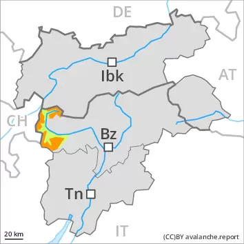
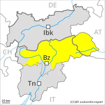
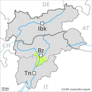
Weakly bonded old snow is to be evaluated with care and prudence. Wet avalanches as the day progresses.
In some places avalanches can be triggered in the faceted old snow and reach medium size, especially on very steep shady slopes above approximately 2200 m, as well as on very steep east and west facing slopes above approximately 2400 m. Caution is to be exercised at transitions from a shallow to a deep snowpack. As the day progresses the likelihood of avalanches being released will increase a little. In addition the somewhat older wind slabs at high altitudes and in high Alpine regions are capable of being triggered in isolated cases still. This applies especially on steep, little used shady slopes.
As a consequence of warming during the day and the solar radiation, the likelihood of wet avalanches being released will increase. This applies especially on steep southeast, south and west facing slopes below approximately 2600 m. Backcountry tours should be concluded timely.
Snowpack
dp.1: deep persistent weak layer dp.10: springtime scenario
Faceted weak layers exist in the old snowpack, especially on shady slopes above approximately 2200 m, as well as on east and west facing slopes above approximately 2400 m. The wind slabs are in individual cases still prone to triggering at high altitudes and in high Alpine regions. Sunshine and high temperatures will give rise as the day progresses to increasing moistening of the snowpack. These conditions will bring about a gradual weakening of the snowpack in particular on steep sunny slopes.
Tendency
Sunday: Slight decrease in danger of wet and gliding avalanches as the temperature drops.
AM Danger level
2200m
Avalanche Problem
Wind slab
2200m
Wet snow
Treeline
PM Danger level
treeline
Avalanche Problem
Wet snow
Treeline
Persistent weak layer
2200m
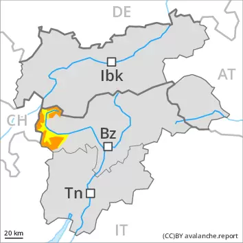
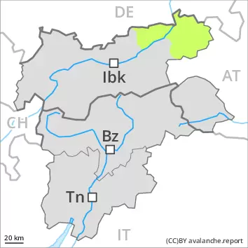
Wet snow represents the main danger. In addition the more recent wind slabs must be taken into account. Weakly bonded old snow in particular on steep shady slopes.
As a consequence of a strong wind from northwesterly directions, sometimes avalanche prone wind slabs formed on Wednesday in particular adjacent to ridgelines and in gullies and bowls. At elevated altitudes the avalanche prone locations are more prevalent. At transitions from a shallow to a deep snowpack the likelihood of avalanches being released is greater. Avalanches can be released in the old snowpack, even by small loads in isolated cases. This applies in particular on very steep shady slopes. Caution is to be exercised at transitions from a shallow to a deep snowpack. As a consequence of warming during the day and solar radiation individual mostly small moist snow slides are to be expected as the day progresses. This applies in particular on sunny slopes, as well as on shady slopes below approximately 2400 m. Backcountry tours and off-piste skiing should be concluded timely.
Snowpack
In some cases the wind slabs have bonded still only poorly with the old snowpack. In some places wind slabs are lying on a hard crust. Individual weak layers exist in the old snowpack in particular on shady slopes. This applies above approximately 2200 m. Sunshine and high temperatures will give rise as the day progresses to gradual moistening of the snowpack in particular on sunny slopes. These conditions will bring about a weakening of the snowpack.
Tendency
On Sunday it will be partly cloudy. Slight decrease in danger of moist and wet snow slides as the temperature drops.
AM Danger level
PM Danger level
Avalanche Problem
Wet snow
Slight increase in danger of wet avalanches in the course of the day.
Late morning: The early morning will see favourable avalanche conditions over a wide area. Midday and afternoon: As a consequence of warming during the day and the solar radiation, the likelihood of wet avalanches during the day being released will increase a little. This applies especially on steep west facing slopes. The avalanches are rather small. In particular in steep rocky terrain more loose snow avalanches are possible.
Snowpack
dp.10: springtime scenario
The weather conditions facilitated a substantial strengthening of the weak layers. Outgoing longwave radiation during the night was good over a wide area. Sunshine and high temperatures will give rise as the day progresses to gradual softening of the snowpack especially on sunny slopes. These conditions will bring about a gradual weakening of the snowpack from midday. Only a small amount of snow is lying for the time of year at low and intermediate altitudes.
Tendency
Low avalanche danger will persist.
Danger level
Avalanche Problem
Wet snow
Wet avalanches as the day progresses.
Avalanches can in isolated cases be released by people, especially on very steep shady slopes at elevated altitudes. On sunny slopes mostly small wet avalanches are to be expected as a consequence of warming during the day and solar radiation.
Snowpack
dp.10: springtime scenario
Hardly any weak layers exist in the old snowpack. Sunshine and high temperatures will give rise as the day progresses to increasing moistening of the snowpack. These conditions will bring about a gradual weakening of the snowpack in particular on steep sunny slopes.
Tendency
Sunday: Slight decrease in danger of wet and gliding avalanches as the temperature drops.
Danger level
In the late morning as a consequence of warming there will be a gradual increase in the danger of moist and wet snow slides. Old wind slabs are to be evaluated with care and prudence.
The wind slabs of the last few days are to be evaluated with care and prudence in particular on steep shady slopes at elevated altitudes. The somewhat older wind slabs are to be avoided in particular in very steep terrain, also adjacent to ridgelines and in gullies and bowls. Sunshine and high temperatures will give rise from early morning to increasing moistening of the snowpack over a wide area in particular on southeast, south and southwest facing slopes. In particular is these aspects individual mostly small moist and wet snow slides are possible as a consequence of warming during the day. Backcountry tours and off-piste skiing should be concluded timely.
Snowpack
The mostly small wind slabs are in some cases still prone to triggering in particular on shady slopes above the tree line. Above approximately 2000 m snow depths vary greatly, depending on the infuence of the wind. In all regions below approximately 2000 m only a little snow is lying. Sunshine and high temperatures will give rise as the day progresses to increasing moistening of the snowpack.
Tendency
On Sunday it will be partly cloudy. Slight decrease in danger of moist and wet snow slides as the temperature drops.