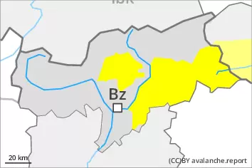
Danger level
 | 2600m |
|  |
|  | ||||
|  |
|  |


![]()
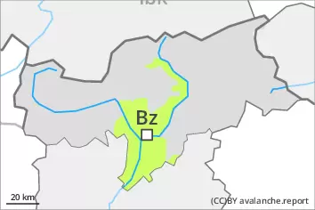
Weakly bonded old snow and wet snow are to be critically assessed.
This is the final hazard map for the winter 2022/23. Regular avalanche bulletins with hazard maps will appear again from around the start of December, depending on the snow situation.
Wet avalanches can in some places be released, even by a single winter sport participant. This applies in all aspects below approximately 2600 m. Avalanches can also release deeper layers of the snowpack and reach large size in isolated cases, especially on steep north facing slopes at high altitude.
In isolated cases dry avalanches can be triggered in the weakly bonded old snow, in particular on very steep shady slopes above approximately 2600 m. Dry avalanches can in isolated cases penetrate deep layers and reach large size.
On steep grassy slopes more gliding avalanches are possible.
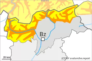
Snowpack
dp.10: springtime scenario
dp.4: cold following warm / warm following cold
The spring-like weather conditions gave rise to thorough wetting of the snowpack over a wide area, especially below approximately 2600 m. Outgoing longwave radiation during the night will be severely restricted. Down to high altitudes snow will fall in particular in the west. The snowpack remains weakly bonded.
Avalanche prone weak layers exist in the old snowpack in particular on steep shady slopes.
Tendency
Tuesday: As a consequence of falling temperatures, the activity of wet avalanches will decrease. Down to high altitudes snow will fall. As a consequence of new snow and a moderate to strong northerly wind, mostly small wind slabs will form in high Alpine regions. This applies especially on the Main Alpine Ridge and to the south.