Danger level
 | 2400m |
|  |
|  | ||||
| |
|  |


![]()
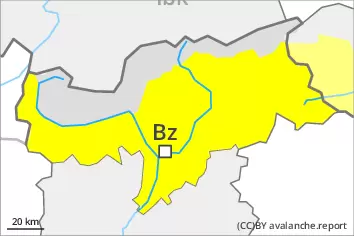
As a consequence of heat and rain an unfavourable avalanche situation will prevail.
From the late morning as a consequence of the rain there will be a rapid increase in the danger of wet avalanches. As the penetration by moisture increases medium-sized and, in isolated cases, large wet and gliding avalanches are possible. This applies in all aspects especially below approximately 2400 m. Especially west, north and east facing slopes are unfavourable.
As a consequence of new snow and a moderate to strong northwesterly wind, mostly small wind slabs will form in high Alpine regions. The fresh wind slabs can be released by a single winter sport participant in isolated cases in particular on very steep shady slopes. They are barely recognisable because of the poor visibility.
Snowpack
dp.3: rain
dp.2: gliding snow
5 to 10 cm of snow, and even more in some localities, will fall above approximately 2400 m. The rain will give rise as the day progresses to a loss of strength within the snowpack below approximately 2400 m.
The wind will be moderate to strong. The fresh wind slabs are bonding well with the old snowpack. They are mostly small and can only be released in isolated cases.
Tendency
The surface of the snowpack will cool hardly at all during the overcast night and will already be soft in the early morning. Wet and gliding avalanches are possible from the early morning, even quite large ones.