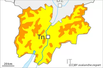
Danger level
 | treeline |
|  |
|  | ||||
|  |
| |


![]()
New snow and wind slabs require caution. Increase in avalanche danger as a consequence of the precipitation.
The large quantity of fresh snow and in particular the wind slabs formed during the snowfall can be released by a single winter sport participant in all aspects above the tree line. Remotely triggered avalanches are possible, in particular in gullies and bowls, and behind abrupt changes in the terrain.
In all aspects and at intermediate and high altitudes more frequent medium-sized and, in isolated cases, large loose snow avalanches are to be expected as the precipitation becomes more intense.
Caution is to be exercised on steep grassy slopes, as well as at the base of rock walls in particular below approximately 2200 m. Areas with glide cracks are to be avoided as far as possible.
Snowpack
dp.6: cold, loose snow and wind
dp.3: rain
Over a wide area 30 to 50 cm of snow, and even more in some localities, fell in the last few days above approximately 1500 m. The wind was strong to storm force at times. In places that are protected from the wind sometimes large wind slabs formed. These are poorly bonded with the old snowpack in all aspects above the tree line.
Over a wide area 20 to 30 cm of snow, and even more in some localities, will fall on Saturday above approximately 2000 m. The wind slabs of the last few days will be covered with new snow in some cases and therefore difficult to recognise.
The rain will give rise to rapid moistening of the snowpack below approximately 2000 m.
Tendency
Over a wide area 20 to 30 cm of snow, and even more in some localities, will fall on Sunday above approximately 1800 m. New snow and wind slabs require caution. The avalanche danger will increase during the day.