Further increase in danger of wet avalanches. From late morning danger level 3 (considerable) will be reached.
The danger of wet avalanches will already increase in the late morning. This applies in all aspects below approximately 2600 m. In particular on very steep west, north and east facing slopes more frequent wet slab avalanches are possible as the penetration by moisture increases, in the regions exposed to rain especially. Avalanches can release the saturated snowpack and reach medium size.
Snowpack
dp.3: rain dp.10: springtime scenario
Outgoing longwave radiation during the night will be severely restricted. The surface of the snowpack will only just freeze and will already be soft in the early morning. The high humditiy will give rise as the day progresses to increasing and thorough wetting of the snowpack below approximately 2600 m. Up to high altitudes rain will fall in some regions. The rain will give rise to a loss of strength within the snowpack especially on west, north and east facing slopes.
Tendency
Wet snow represents the main danger.
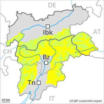
Danger level
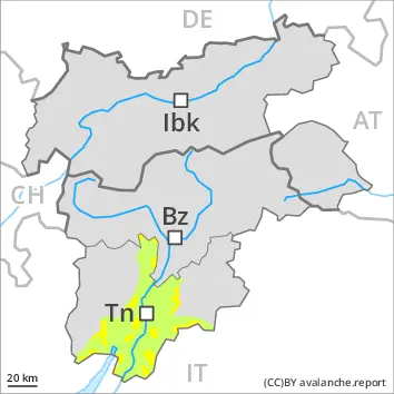
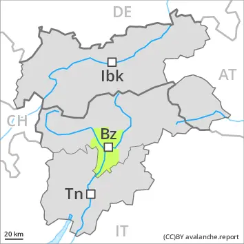
2600m
Avalanche Problem
Wet snow
2600m
Increase in danger of wet and gliding avalanches from late morning.
The surface of the snowpack is frozen, but not to a significant depth and will soften quickly. From late morning the likelihood of moist and wet avalanches being released will increase. As the penetration by moisture increases individual natural wet avalanches are possible as the day progresses, in particular on very steep west, north and east facing slopes below approximately 2600 m, in the regions exposed to rain especially. Avalanches can release the saturated snowpack and reach medium size. Gliding avalanches can also occur. The avalanche prone locations for gliding avalanches are to be found in particular on very steep grassy slopes below approximately 2600 m.
Snowpack
dp.10: springtime scenario dp.2: gliding snow
Outgoing longwave radiation during the night will be reduced. The surface of the snowpack will cool hardly at all during the overcast night. Up to high altitudes rain will fall from late morning in some localities, especially in the south. The spring-like weather conditions as the day progresses will give rise to increasing and thorough wetting of the snowpack in all aspects below approximately 2600 m.
Tendency
Wet snow represents the main danger.
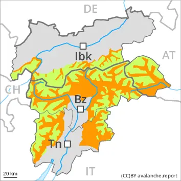
Danger level
1800m
Avalanche Problem
Wet snow
1800m
Low avalanche danger will prevail. The danger of moist and wet avalanches will increase during the day.
As a consequence of warming during the day individual moist snow slides and avalanches are possible, but they will be mostly small. The avalanche prone locations are to be found in particular on very steep shady slopes above approximately 1800 m.
Snowpack
dp.10: springtime scenario
The snowpack will be subject to considerable local variations.
Tendency
The avalanche danger will persist.
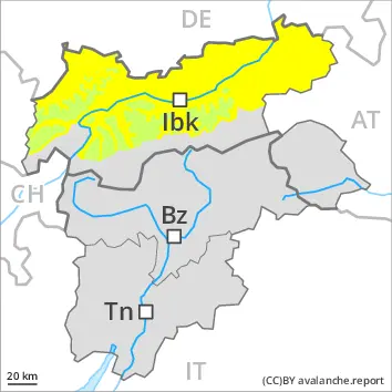
Danger level
Avalanche Problem
Wet snow
The danger of wet avalanches will increase.
As the penetration by moisture increases individual wet avalanches are possible, but they will be mostly small.
Snowpack
Outgoing longwave radiation during the night will be severely restricted. The surface of the snowpack will freeze very little and will already be soft in the early morning. The high humditiy will give rise to increasing and thorough wetting of the snowpack. Some rain will fall in some regions. The rain will give rise to a loss of strength within the snowpack. Only a little snow is now lying.