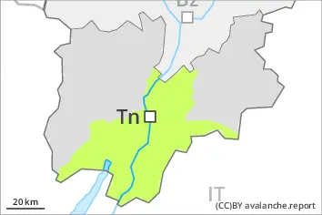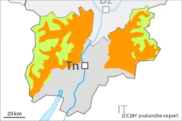
Danger level
 | 2600m |
|  |
|  |

![]()
Wet snow represents the main danger. As the penetration by moisture increases wet avalanches are possible at any time.
The danger of wet avalanches will persist. In particular on very steep west, north and east facing slopes more frequent natural wet avalanches are possible as the penetration by moisture increases. Avalanches can release the saturated snowpack and reach medium size.
The conditions are unfavourable for backcountry touring, in particular at intermediate and high altitudes.
Snowpack
dp.10: springtime scenario
dp.3: rain
Outgoing longwave radiation during the night will be severely restricted. The surface of the snowpack will only just freeze and will already be soft in the early morning. The high temperatures will give rise to increasing and thorough wetting of the snowpack below approximately 2600 m. These weather conditions will give rise to a loss of strength within the snowpack.
Tendency
Wet snow represents the main danger.