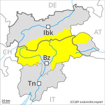
Wet snow represents the main danger. Wind slabs in the high Alpine regions.
Wet avalanches can as before be released by a single winter sport participant. The avalanche prone locations are to be found especially on very steep west, north and east facing slopes below approximately 2600 m. Avalanches can release the saturated snowpack and reach medium size. Some rain will fall during the night in some regions. As a consequence of the rain, the likelihood of avalanches being released will increase.
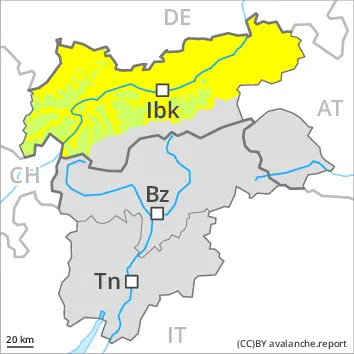
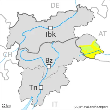
The wind slabs can be released by a single winter sport participant in isolated cases in particular on very steep shady slopes in high Alpine regions. Such avalanche prone locations are to be found adjacent to ridgelines.
Snowpack
dp.3: rain dp.9: graupel blanketed with snow
Over a wide area an overcast night. The old snowpack is wet. This applies on shady slopes below approximately 2600 m, as well as on sunny slopes below approximately 3000 m. Up to intermediate altitudes rain will fall over a wide area. Above approximately 2400 m snow will fall.
High Alpine regions: Wind slabs are lying on soft layers on very steep shady slopes.
Tendency
Up to high altitudes rain will fall over a wide area. Over a wide area up to 20 cm of snow, and even more in some localities, will fall above approximately 2200 m. The surface of the snowpack is not frozen and will already be soft in the early morning.
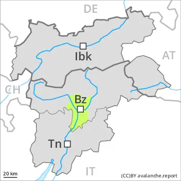
Danger level
2000m
Avalanche Problem
Wet snow
2600m
2000m
Wind slab
2800m
Wet snow represents the main danger. Old wind slabs require caution.
Up to high altitudes rain has fallen since yesterday over a wide area. As a consequence of the rain, the likelihood of moist and wet avalanches being released will increase. Wet avalanches can as before be released by a single winter sport participant. The avalanche prone locations are to be found especially on very steep west, north and east facing slopes below approximately 2600 m. Avalanches can release the saturated snowpack and reach large size in isolated cases.
Old wind slabs require caution. The wind slabs can be released by a single winter sport participant in isolated cases in particular on very steep shady slopes in high Alpine regions. Such avalanche prone locations are to be found especially adjacent to ridgelines.
Snowpack
dp.10: springtime scenario dp.3: rain
Over a wide area an overcast night. The surface of the snowpack will only just freeze and will already be soft in the early morning. Up to 2400 m rain will fall over a wide area. The rain will give rise as the day progresses to increasing and thorough wetting of the snowpack below approximately 2400 m. This situation will give rise to a loss of strength within the snowpack in particular on steep slopes.
The old snowpack is wet.
Wind slabs are lying on soft layers on very steep shady slopes. High Alpine regions: On steep sunny slopes as well as at low and intermediate altitudes only a little snow is lying.
Tendency
In some regions 5 cm of snow, and even more in some localities, will fall above approximately 2000 m. Up to intermediate altitudes rain will fall over a wide area. The danger of moist and wet snow slides will increase during the day.
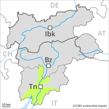
Danger level
2600m
Avalanche Problem
Wet snow
2600m
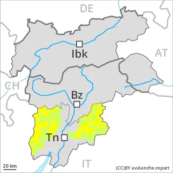
Wet snow represents the main danger.
Wet avalanches can in some places be released by a single winter sport participant. Wherever a lot of rain falls the danger will increase more quickly. The avalanche prone locations are to be found especially on very steep west, north and east facing slopes below approximately 2600 m. Avalanches can release the saturated snowpack and reach medium size.
Individual gliding avalanches can also occur, caution is to be exercised in particular on very steep grassy slopes in the regions with a lot of snow.
Snowpack
dp.3: rain
Over a wide area an overcast night. The old snowpack is wet. Up to intermediate altitudes rain will fall. Above approximately 2200 m snow will fall. The wind will be light over a wide area. On steep sunny slopes as well as at low and intermediate altitudes hardly any snow is lying.
Tendency
Some rain will fall over a wide area. Above approximately 1800 m snow will fall. The wind will be light.
Danger level
2600m
Avalanche Problem
Wet snow
2600m
Wet snow represents the main danger.
Wet avalanches can as before be released by a single winter sport participant. The avalanche prone locations are to be found especially on very steep west, north and east facing slopes below approximately 2600 m. Avalanches can release the saturated snowpack and reach medium size. Some rain will fall in the afternoon in some regions. As a consequence of the rain, the likelihood of avalanches being released will increase.
Snowpack
dp.3: rain
Over a wide area an overcast night. The old snowpack is wet. Up to intermediate altitudes rain will fall. Above approximately 2200 m snow will fall. The wind will be light over a wide area. On steep sunny slopes as well as at low and intermediate altitudes hardly any snow is lying.
Tendency
Up to 2000 m and above rain will fall over a wide area. Up to 10 cm of snow, and even more in some localities, will fall above approximately 2200 m.
Danger level
Low avalanche danger will prevail.
Only isolated wet avalanches are possible.
Snowpack
Outgoing longwave radiation during the night will be severely restricted. The surface of the snowpack will cool hardly at all during the overcast night and will already be soft in the early morning. The snowpack will be wet all the way through. Only a little snow is now lying.
Tendency
Only isolated wet avalanches are possible.
Danger level
Low avalanche danger will prevail.
Only isolated wet avalanches are possible.
Snowpack
The surface of the snowpack will cool hardly at all during the overcast night and will already be soft in the early morning. The rain will give rise as the day progresses to increasing and thorough wetting of the snowpack. This situation will give rise to a loss of strength within the snowpack on steep slopes. In all regions at low and intermediate altitudes only a little snow is lying.
Tendency
Up to intermediate altitudes rain will fall over a wide area. The danger of moist and wet snow slides will increase during the day.