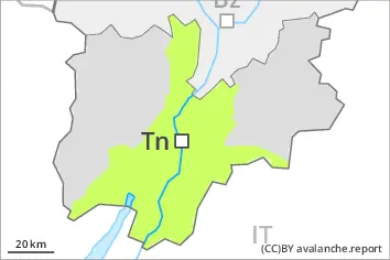
Danger level
 | 2500m |
|  |
|  | ||||
|  |
|  |


![]()
Wind slabs at high altitude. Wet snow requires caution.
More recent wind slabs can be released by a single winter sport participant in some cases at elevated altitudes. Such avalanche prone locations are to be found adjacent to ridgelines and in gullies and bowls. Mostly avalanches are only small.
Some snow will fall on Sunday in some regions. This applies especially above approximately 2500 m.
Wet avalanches can in very isolated cases be released by a single winter sport participant. Some rain will fall until Monday in some regions. This applies below approximately 2500 m. Natural wet avalanches are possible as a consequence of warming during the day. The avalanche prone locations are to be found especially on very steep west, north and east facing slopes below approximately 2500 m. Mostly wet avalanches are only small.
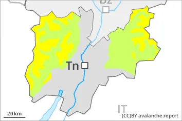
Snowpack
dp.10: springtime scenario
dp.3: rain
The surface of the snowpack will cool hardly at all during the overcast night and will soften during the day.
The old snowpack is wet and its surface has a crust that is not capable of bearing a load. This applies on shady slopes in particular below approximately 2500 m.
Some snow will fall in some regions.
Tendency
The surface of the snowpack will freeze very little and will soften during the day.