EARLIER
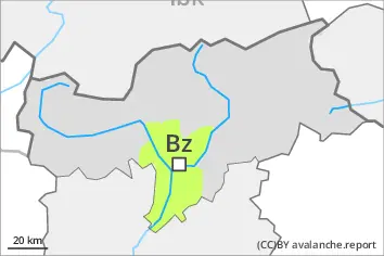
Danger level
 |
LATER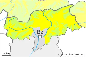
Danger level
 | 2800m |
|  |
|  |

The danger of wet avalanches will increase during the day.
As a consequence of warming during the day and the solar radiation, the likelihood of wet avalanches being released will increase. The avalanche prone locations are to be found especially on very steep west, north and east facing slopes below approximately 2800 m. In the afternoon the activity of wet avalanches will increase, in the event of rain especially. Mostly avalanches are only small.
The wind slabs are now only very rarely prone to triggering. Individual avalanche prone locations are to be found in particular on very steep shady slopes in high Alpine regions and adjacent to ridgelines and in gullies and bowls. Mostly avalanches are only small.
The Avalanche Warning Service currently has only a small amount of information that has been collected in the field, so that the avalanche danger should be investigated especially thoroughly in the relevant locality.
Snowpack
dp.10: springtime scenario
dp.3: rain
In some regions a partly clear night. The surface of the snowpack will freeze to form a strong crust and will soften during the day. The old snowpack is wet. This applies on shady slopes below approximately 2800 m, as well as on sunny slopes below approximately 3200 m. Up to 2400 m and above rain will fall in the afternoon in some localities.
Tendency
In some regions a clear night. The surface of the snowpack will freeze to form a strong crust and will soften during the day. Mostly avalanches are only small.