As a consequence of new snow and a sometimes strong wind, wind slabs formed in the last few days in gullies and bowls and behind abrupt changes in the terrain. These can in some cases be released, even by a single winter sport participant, but they will be small in most cases. Caution is to be exercised in particular on northeast, north and northwest facing slopes above the tree line in the regions exposed to heavier precipitation.
Snowpack
10 to 25 cm of snow fell on Wednesday. The wind was strong for a temporary period in some regions. The fresh wind slabs are lying on the unfavourable surface of an old snowpack on wind-protected shady slopes. The snowpack will be subject to considerable local variations. Less snow than usual is lying in all altitude zones.
Tendency
Weak layers in the upper part of the snowpack can be released in particular in the regions with a lot of snow.
Danger level
treeline
Avalanche Problem
Wind slab
Treeline
Wind slabs require caution.
As a consequence of new snow and a gusty wind, wind slabs formed in gullies and bowls and behind abrupt changes in the terrain. These can in some cases be released, even by a single winter sport participant, but they will be small in most cases. Caution is to be exercised in particular on northwest, north and northeast facing slopes above the tree line in the regions exposed to heavier precipitation.
Snowpack
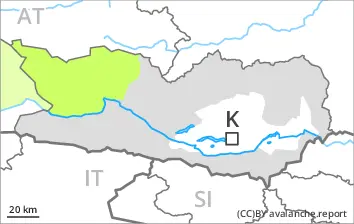
10 to 20 cm of snow, and even more in some localities, fell on Wednesday. The wind was strong at times in particular from the Koralpe West via the Packalpe to the Saualpe South. The wind slabs are lying on the unfavourable surface of an old snowpack on wind-protected northwest, north and northeast facing slopes. At intermediate and high altitudes only a small amount of snow is lying for the time of year.
Tendency
Low avalanche danger will persist.
Danger level
2600m
Avalanche Problem
Persistent weak layer
2600m
Weakly bonded old snow represents the main danger.
In isolated cases avalanches can be triggered in the weakly bonded old snow. Such avalanche prone locations are to be found in particular on extremely steep shady slopes above approximately 2600 m.
As a consequence of new snow and a gusty wind, sometimes avalanche prone wind slabs formed in particular on northwest, north and northeast facing slopes. Caution is to be exercised adjacent to ridgelines and in gullies and bowls at elevated altitudes. Mostly avalanches are small.
Apart from the danger of being buried, restraint should be exercised in particular in view of the danger of avalanches sweeping people along and giving rise to falls.
Snowpack
dp.1: deep persistent weak layer
Up to 10 cm of snow fell on Wednesday. The wind was strong for a temporary period in some regions.
Shady slopes above approximately 2600 m: Faceted weak layers exist in the bottom section of the snowpack.
Below approximately 2600 m: The snowpack is largely stable. Hardly any snow is lying on south facing slopes.
The snowpack will be generally subject to considerable local variations. Less snow than usual is lying in all altitude zones.