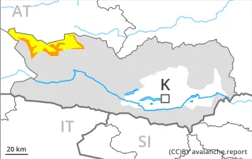
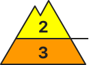
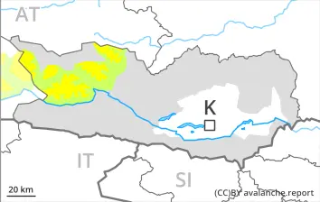
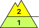
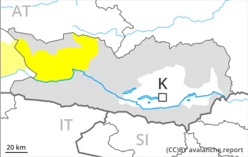
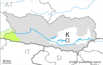
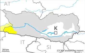
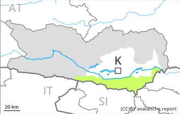
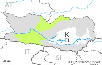
Increase in danger of wet avalanches in the course of the day.
As the day progresses the likelihood of wet avalanches being released will increase. Especially in places where the outgoing longwave radiation during the night is reduced the danger will increase earlier.
As the penetration by moisture increases individual wet slab avalanches are possible as the day progresses, in particular medium-sized ones. This applies especially in case of releases originating from shady starting zones, but in isolated cases also in case of releases originating from high-altitude sunny starting zones that have retained the snow thus far.
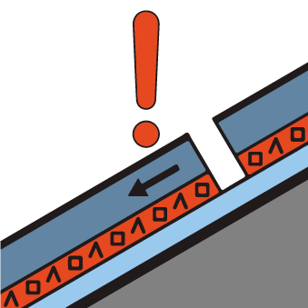
Individual avalanche prone locations for dry avalanches are to be found on very steep shady slopes above approximately 2500 m. Especially transitions from a shallow to a deep snowpack are unfavourable. The avalanche prone locations are difficult to recognise.
Snowpack
dp.10: springtime scenario dp.1: deep persistent weak layer
Outgoing longwave radiation during the night will be reduced at times. The surface of the snowpack will soften quickly. Sunshine and high temperatures will give rise to increasing and thorough wetting of the snowpack below approximately 3000 m. West, north and east facing slopes above approximately 2500 m: Faceted weak layers exist in the bottom section of the old snowpack at elevated altitudes.
Tendency
The danger of wet avalanches will persist.
EARLIER Danger level
2500m
Avalanche Problem
Persistent weak layer
2500m
LATER Danger level
3000m
Avalanche Problem
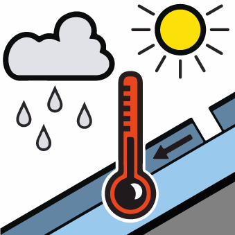
Wet snow
3000m
Persistent weak layer
2500m
Increase in danger of wet avalanches in the course of the day.
As the day progresses as a consequence of warming during the day and solar radiation there will be an increase in the danger of wet avalanches. Wet avalanches can in some places be released by a single winter sport participant. This applies on very steep shady slopes below approximately 2500 m, as well as on very steep sunny slopes at elevated altitudes. Small and medium-sized natural avalanches are possible in the afternoon.
Individual avalanche prone locations for dry avalanches are to be found on very steep shady slopes above approximately 2500 m. Especially transitions from a shallow to a deep snowpack are unfavourable. The avalanche prone locations are difficult to recognise.
Snowpack
dp.10: springtime scenario dp.1: deep persistent weak layer
The surface of the snowpack will freeze to form a strong crust and will soften during the day. Sunshine and high temperatures will give rise to gradual softening of the snowpack at intermediate and high altitudes. Steep slopes: Faceted weak layers exist in the bottom section of the old snowpack at elevated altitudes.
Tendency
Outgoing longwave radiation during the night will be reduced. The backcountry touring conditions in the morning at elevated altitudes are generally favourable. As the day progresses as a consequence of warming during the day there will be an increase in the danger of wet avalanches. Some rain will fall in some regions.
EARLIER Danger level
LATER Danger level
Avalanche Problem
Wet snow
Individual avalanche prone locations for wet avalanches are to be found in particular on very steep shady slopes.
As the day progresses the likelihood of wet avalanches being released will increase. In the regions where the outgoing longwave radiation during the night is reduced the danger will increase earlier.
As the penetration by moisture increases individual wet slab avalanches are possible as the day progresses. This applies in particular in case of releases originating from high-altitude shady starting zones that have retained the snow thus far, especially between approximately 2200 and 2600 m. In isolated cases avalanches are medium-sized. Avalanches can release the wet snowpack. This extends the avalanche runout distances.
Snowpack
dp.10: springtime scenario
During the night the weather will be partly cloudy in some regions. This applies in particular in the east. The snowpack is wet and its surface has a melt-freeze crust. The surface of the snowpack will soften quickly. In particular on steep sunny slopes as well as below approximately 1800 m only a little snow is now lying.
Tendency
The danger of wet avalanches will persist.
Danger level
Avalanche Problem
Wet snow
Individual avalanche prone locations for wet avalanches are to be found in particular on very steep shady slopes.
Wet avalanches can in very isolated cases be released by small loads and reach medium size. As a consequence of warming during the day only isolated natural wet avalanches are possible. Caution is to be exercised on very steep shady slopes. In steep gullies avalanches can in isolated cases reach areas without any snow cover. The runout zones are to be avoided.
Snowpack
dp.10: springtime scenario
The snowpack will be wet all the way through over a wide area. The surface of the snowpack will only just freeze and will soften quickly. On steep sunny slopes as well as below approximately 1600 m only a little snow is now lying.
Tendency
Many starting zones have released the snow.
Danger level
Avalanche Problem
Wet snow
Individual avalanche prone locations for wet avalanches are to be found in particular on extremely steep shady slopes.
Only isolated wet avalanches are possible. Caution is to be exercised on extremely steep shady slopes. Mostly avalanches are small.
Snowpack
dp.10: springtime scenario
The snowpack will be wet all the way through over a wide area. The surface of the snowpack will only just freeze and will soften quickly. On steep sunny slopes as well as below approximately 1800 m hardly any snow is lying.