Increase in danger of wet avalanches in the course of the day.
As a consequence of warming during the day and solar radiation there will be an increase in the danger of wet avalanches. In particular at the base of rock walls avalanches can be released naturally. Individual avalanche prone locations for dry avalanches are to be found on very steep shady slopes above approximately 2500 m. Such avalanche prone locations are difficult to recognise. The danger of ground avalanches will increase during the day.
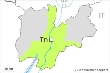
Snowpack
dp.10: springtime scenario dp.1: deep persistent weak layer
The surface of the snowpack will soften during the day. Sunshine and high temperatures will give rise to increasing and thorough wetting of the snowpack below approximately 3000 m. Steep west, north and east facing slopes above approximately 2500 m: Faceted weak layers exist in the bottom section of the old snowpack. Below approximately 2000 m from a snow sport perspective, in most cases insufficient snow is lying.
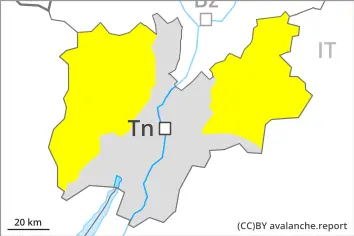
Tendency
Sunday: The avalanche danger will persist.
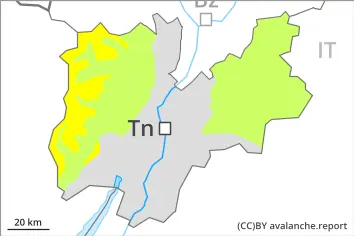
Danger level
Wet snow requires caution.
Only isolated wet avalanches are possible. Caution is to be exercised on extremely steep shady slopes. Mostly avalanches are rather small.
Below approximately 2000 m from a snow sport perspective, in most cases insufficient snow is lying.
Snowpack
dp.10: springtime scenario
The surface of the snowpack will soften during the day.