Weak layers in the old snowpack necessitate caution. Wet snow is to be evaluated critically.
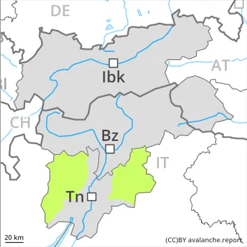
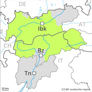
As the day progresses as a consequence of warming there will be a gradual increase in the avalanche danger. On very steep slopes the moist avalanches can be released naturally and reach medium size in isolated cases. As a consequence of wind, wind slabs formed on Friday at high altitude. Individual avalanche prone locations are to be found on very steep shady slopes above approximately 2600 m. Avalanches can be released, mostly by large loads and reach medium size.
Snowpack
dp.10: springtime scenario
Below approximately 2500 m a little snow is lying. The spring-like weather conditions will give rise to rapid moistening of the snowpack. The surface of the snowpack will freeze to form a strong crust only at high altitudes and will soften quickly. Steep northwest, north and northeast facing slopes above approximately 2500 m: Faceted weak layers exist in the bottom section of the old snowpack.
Tendency
The early morning will see favourable conditions generally. Increase in danger of wet avalanches as a consequence of warming during the day and solar radiation.
Danger level
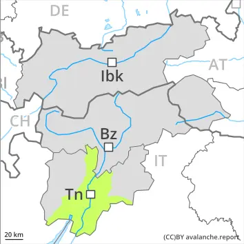
Only a little snow is lying.
Hardly any more wet avalanches are possible. Caution is to be exercised on extremely steep shady slopes. Avalanches are only small.
This is the final hazard map for the winter 2025/26. Current information and announcements are posted on our blog. We wish all users of the Euregio Avalanche Report an accident-free summer season.
Snowpack
dp.10: springtime scenario
The surface of the snowpack has frozen to form a strong crust and will soften quickly. Only a little snow is now lying.
Tendency
Low avalanche danger will prevail.
Danger level
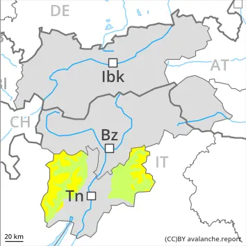
Slight increase in danger of wet snow slides in the course of the day.
As a consequence of warming during the day and the solar radiation, the likelihood of wet snow slides being released will increase a little. Individual avalanche prone locations are to be found on extremely steep slopes at high altitude.
This is the final hazard map for the winter 2025/26. Current information and announcements are posted on our blog. We wish all users of the Euregio Avalanche Report an accident-free summer season.
Snowpack
dp.10: springtime scenario
Outgoing longwave radiation during the night will be good over a wide area. The surface of the snowpack will freeze to form a strong crust and will soften during the day. At low and intermediate altitudes hardly any snow is lying.
Tendency
Low avalanche danger will prevail.
Danger level
2500m
Avalanche Problem
Wet snow
2500m
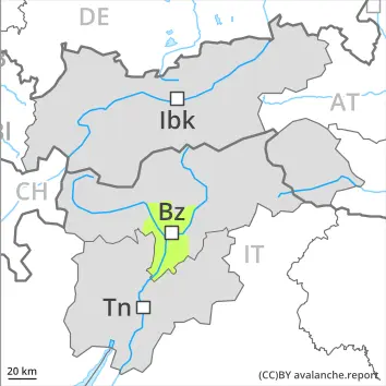
Slight increase in danger of wet avalanches in the course of the day.
As the day progresses as a consequence of warming during the day and solar radiation there will be only a slight increase in the danger of wet avalanches. Wet avalanches can in isolated cases be released by people, especially on very steep sunny slopes above approximately 2500 m, this also applies on very steep shady slopes below approximately 2500 m in gullies and bowls. In isolated cases avalanches are medium-sized.
Weak layers in the old snowpack can be released in isolated cases and mostly by large additional loads in particular on very steep shady slopes, in particular above approximately 2500 m.
In steep terrain there is a danger of falling on the hard snow surface.
This is the final hazard map for the winter 2025/26. Current information and announcements are posted on our blog. We wish all users of the Euregio Avalanche Report an accident-free summer season.
Snowpack
dp.10: springtime scenario dp.1: deep persistent weak layer
Outgoing longwave radiation during the night will be good over a wide area. The surface of the snowpack will freeze to form a strong crust and will soften during the day.
Shady slopes above approximately 2500 m: Faceted weak layers exist in the bottom section of the old snowpack at elevated altitudes.
Below approximately 2000 m no snow is lying. Between approximately 2000 and 2500 m only a little snow is now lying.
Tendency
The early morning will see favourable conditions generally. Slight increase in danger of wet avalanches as a consequence of warming during the day and solar radiation.
Danger level
Low avalanche danger will prevail.
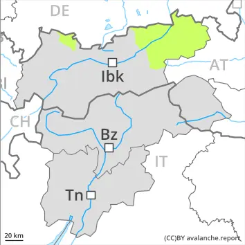
The danger of moist and wet avalanches will already exist in the early morning. From origins in starting zones where no previous releases have taken place individual wet avalanches are possible, but they will be mostly small. Caution is to be exercised on extremely steep shady slopes.
Snowpack
dp.10: springtime scenario
Above approximately 2000 m thus far only a little snow is lying. This applies in gullies and bowls on shady slopes. Outgoing longwave radiation during the night will be barely evident over a wide area. The surface of the snowpack will soften quickly.