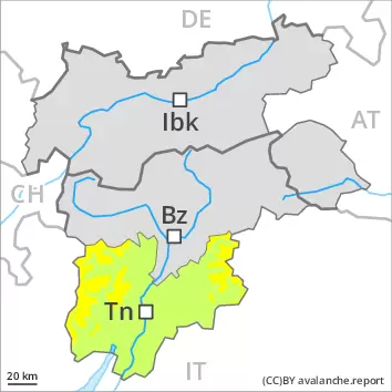
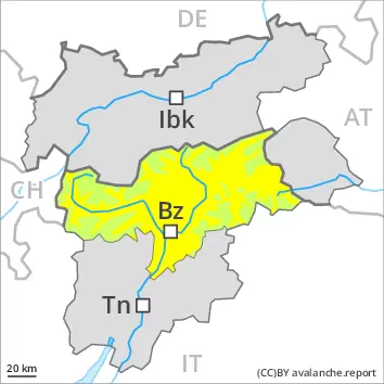
Avalanche.report

Saturday 27.04.2024

Published 26 04 2024, 17:00

EARLIER

Danger level

2200m
Avalanche Problem
Persistent weak layer
2200m

LATER

Danger level

2200m
Avalanche Problem
Persistent weak layer
2200m
Wet snow
2800m

Weak layers in the upper part of the snowpack necessitate caution. Increase in danger of wet and gliding avalanches in the course of the day.

Weak layers in the upper part of the snowpack can be released in isolated cases by winter sport participants. Caution is to be exercised in particular on very steep slopes above approximately 2200 m. Especially shady slopes are unfavourable. Mostly avalanches are medium-sized. The avalanche prone locations are difficult to recognise.

As the day progresses as a consequence of warming during the day and solar radiation there will be a gradual increase in the danger of wet and gliding avalanches.
Especially on rocky east, south and west facing slopes small to medium-sized wet avalanches are to be expected. This also applies on shady slopes below approximately 2400 m.
In addition individual small and medium-sized gliding avalanches are possible. This applies on steep grassy slopes below approximately 2600 m. Areas with glide cracks are to be avoided.

Snowpack

dp.4: cold following warm / warm following cold
dp.10: springtime scenario

At the interface between the old snow surface and the new snow of the past week, occasionally a faceted weak layer developed. This applies above approximately 2200 m.
As a consequence of a sometimes strong southerly foehn wind, small wind slabs will form in the vicinity of peaks, especially in high Alpine regions on the Main Alpine Ridge and to the north. The weather effects will bring about a rapid stabilisation of the snow drift accumulations.
The spring-like weather conditions will give rise to gradual softening of the snowpack especially on sunny slopes. This also applies on shady slopes below approximately 2400 m.
The old snowpack will be stable.

Tendency

Weak layers in the upper part of the snowpack necessitate caution. Wet loose snow avalanches and gliding avalanches are still possible.

EARLIER

Danger level

2200m
Avalanche Problem
Persistent weak layer
2200m

LATER

Danger level

2200m
Avalanche Problem
Persistent weak layer
2200m
Wet snow
2800m

Weak layers in the upper part of the snowpack necessitate caution. Increase in danger of wet and gliding avalanches in the course of the day.

Weak layers in the upper part of the snowpack can be released in isolated cases by winter sport participants. Caution is to be exercised in particular on very steep slopes above approximately 2200 m. Especially shady slopes are unfavourable. Mostly avalanches are medium-sized. The avalanche prone locations are difficult to recognise.

As the day progresses as a consequence of warming during the day and solar radiation there will be a gradual increase in the danger of wet and gliding avalanches.
Especially on rocky east, south and west facing slopes small to medium-sized wet avalanches are to be expected as the penetration by moisture increases.
In addition further gliding avalanches are possible. This applies on steep grassy slopes below approximately 2600 m. Areas with glide cracks are to be avoided.

Snowpack

dp.4: cold following warm / warm following cold
dp.10: springtime scenario

At the interface between the old snow surface and the new snow of the past week, occasionally a faceted weak layer developed. This applies above approximately 2200 m.
Sunshine and high temperatures will give rise as the day progresses to gradual softening of the snowpack especially on sunny slopes.
The old snowpack will be stable.

Tendency

Weak layers in the upper part of the snowpack necessitate caution. Wet loose snow avalanches and gliding avalanches are still possible.


Danger level

treeline
Avalanche Problem
Wind slab
Treeline
Persistent weak layer
2200m


Old wind slabs require caution. Weak layers in the upper part of the snowpack necessitate caution and restraint.

Some small and, in isolated cases, medium-sized loose snow avalanches are possible as a consequence of warming during the day, especially on very steep sunny slopes.

The wind slabs of recent weeks can be released, especially by large additional loads, above the tree line, caution is to be exercised in particular adjacent to ridgelines, as well as at the base of rock walls and behind abrupt changes in the terrain.
Weak layers in the upper part of the snowpack can be released in some places especially above approximately 2200 m.

Individual gliding avalanches are possible, caution is to be exercised on steep slopes below approximately 2200 m. Areas with glide cracks are to be avoided.

Snowpack

dp.6: cold, loose snow and wind

Wind slabs are lying on soft layers in particular on shady slopes above the tree line. The old snowpack is well consolidated. In some places new snow and wind slabs are lying on an icy crust.

Tendency

Weak layers in the upper part of the snowpack necessitate caution. Wet loose snow avalanches and gliding avalanches are possible.

EARLIER

Danger level


LATER

Danger level


Avalanche Problem
Wet snow

Increase in danger of wet and gliding avalanches in the course of the day.

As the day progresses as a consequence of warming during the day and solar radiation there will be a gradual increase in the danger of wet and gliding avalanches.
Especially on rocky east, south and west facing slopes small to medium-sized wet loose snow avalanches are to be expected as the penetration by moisture increases.
In addition further small and, in isolated cases, medium-sized gliding avalanches are possible. This applies on steep grassy slopes. Areas with glide cracks are to be avoided.

Snowpack

dp.10: springtime scenario
dp.2: gliding snow

Sunshine and high temperatures will give rise as the day progresses to gradual softening of the snowpack especially on sunny slopes. The old snowpack will be stable.

Tendency

Wet loose snow avalanches and gliding avalanches are still possible.