Ski touring is to be restricted to controlled terrain as far as possible.
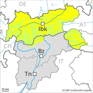
The new snow of the last two days represents the main danger. This snow can be released easily or naturally in all aspects above the tree line. The new snow can be released by a single winter sport participant especially on west to north to south facing aspects above the tree line. Over a wide area 50 cm of snow, and up to 70 cm in some localities, will fall until the early morning above approximately 1800 m. In particular in the regions exposed to heavier precipitation numerous medium-sized and, in isolated cases, large slab avalanches are to be expected as the snowfall becomes more intense. As a consequence of new snow and a sometimes storm force wind, sometimes large wind slabs will form in the course of the day in all aspects. The off-piste conditions are dangerous. Temporary safety measures may be necessary.
Snowpack
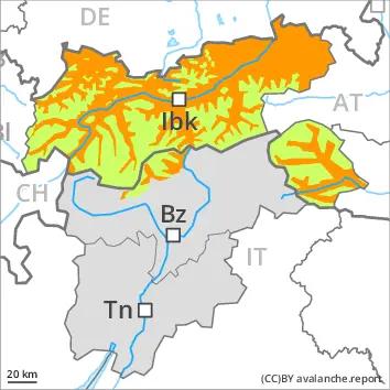
As a consequence of sharply rising temperatures and rain up to high altitudes a critical avalanche situation will develop. The old snowpack is faceted and weak. The rain will give rise to extreme and thorough wetting of the snowpack in all aspects below approximately 2400 m. These conditions will cause a very rapid weakening of the snowpack. The snowpack is moist and its surface has a melt-freeze crust that is strong in many cases. This applies in particular on steep sunny slopes above the tree line. The surface of the snowpack will soften during the day. Sunshine and high temperatures will give rise as the day progresses to a loss of strength within the snowpack over a wide area in particular on very steep sunny slopes.