Weakly bonded old snow and wet snow require caution.
Weak layers in the old snowpack can be released in very isolated cases by individual winter sport participants, especially at transitions from a shallow to a deep snowpack, when entering gullies and bowls for example, as well as in little used backcountry terrain. The avalanche prone locations are rare but are difficult to recognise. In isolated cases avalanches are medium-sized. In steep terrain there is a danger of falling on the hard snow surface. In the next few hours the weather will be cloudy. Below approximately 2000 m mostly small wet and gliding avalanches are possible as a consequence of the rain.
Snowpack
dp.1: deep persistent weak layer dp.3: rain
The snowpack will be quite well bonded. Faceted weak layers exist in the snowpack, especially on shady slopes above approximately 2200 m, and on sunny slopes at elevated altitudes. On Sunday the wind will be strong in the vicinity of peaks. Above approximately 2000 m snow will fall in some regions. The wind will transport only a little snow.
Below approximately 2000 m: The surface of the snowpack is hardly frozen at all. Some rain will fall. The rain will give rise to significant softening of the snowpack.
Tendency
The wind will be strong adjacent to ridgelines in some regions. Slight increase in danger of wet and gliding avalanches in the course of the day.
AM Danger level
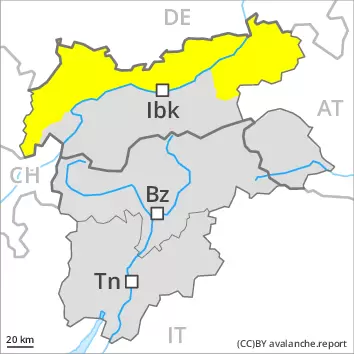
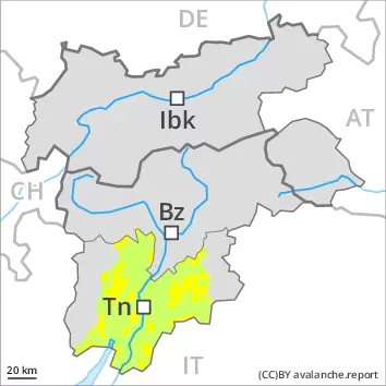
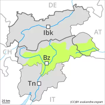
2200m
Avalanche Problem
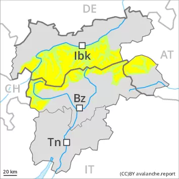
Persistent weak layer
2200m
PM Danger level
treeline
Avalanche Problem
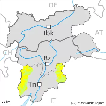
Wet snow
Treeline
Persistent weak layer
2200m
Weakly bonded old snow and wet snow require caution.
The early morning will see quite favourable conditions generally. Weak layers in the old snowpack can still be released in some places by individual winter sport participants, especially at transitions from a shallow to a deep snowpack, when entering gullies and bowls for example, as well as in little used backcountry terrain. The avalanche prone locations are rare but are difficult to recognise. Mostly avalanches are medium-sized. On very steep sunny slopes small and medium-sized moist and wet avalanches are possible as a consequence of warming during the day. Backcountry tours should be concluded before midday.
Snowpack
The snowpack will be quite well bonded. Isolated avalanche prone weak layers exist in the snowpack, especially on shady slopes above approximately 2200 m. On Saturday the wind will be strong in the vicinity of peaks. The wind will transport only a little snow. The weather will be mild. The surface of the snowpack is frozen, but not to a significant depth and will soften during the day. At intermediate altitudes only a small amount of snow is lying for the time of year.
Tendency
On Sunday the wind will be strong adjacent to ridgelines in some regions. Increase in danger of moist avalanches in the course of the day.
Danger level
2200m
Avalanche Problem
Persistent weak layer
2200m
Weakly bonded old snow and wet snow require caution.
Currently there are quite favourable conditions generally. Weak layers in the old snowpack can still be released in some places by individual winter sport participants, especially at transitions from a shallow to a deep snowpack, when entering gullies and bowls for example, as well as in little used backcountry terrain. The avalanche prone locations are rare but are difficult to recognise. Avalanches are medium-sized. On extremely steep sunny slopes individual small to medium-sized wet avalanches are possible as a consequence of warming during the day and solar radiation, in particular below approximately 2400 m.
Snowpack
dp.1: deep persistent weak layer
The snowpack will be quite well bonded. Isolated avalanche prone weak layers exist in the bottom section of the snowpack, especially on shady slopes above approximately 2200 m, and on sunny slopes at elevated altitudes. On Sunday the wind will be strong to storm force in some cases. The wind will transport only a little snow. The surface of the snowpack has frozen to form a strong crust. Sunshine and high temperatures will give rise as the day progresses to gradual softening of the snowpack. This applies especially on sunny slopes below approximately 2400 m. The surface of the snowpack will soften later than the day before. The snowpack will be subject to considerable local variations above the tree line. At low and intermediate altitudes less snow than usual is lying.
Tendency
The weather will be mild. Slight increase in danger of wet avalanches in the course of the day.
AM Danger level
PM Danger level
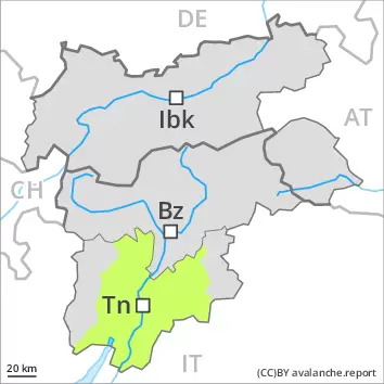
treeline
Avalanche Problem
Wet snow
Treeline
The early morning will see favourable conditions mostly, but the danger of wet avalanches will increase later.
On very steep sunny slopes small to medium-sized wet avalanches are possible as a consequence of warming during the day. Backcountry tours should be concluded timely. Individual avalanche prone locations for dry avalanches are to be found in particular on extremely steep shady slopes and at transitions from a shallow to a deep snowpack. These places are very rare and are difficult to recognise. In steep terrain there is a danger of falling on the hard snow surface.
Snowpack
The snowpack is favourably layered and its surface has a melt-freeze crust that is barely capable of bearing a load, in particular on steep sunny slopes. Sunshine and high temperatures will give rise as the day progresses to gradual moistening of the snowpack. Faceted weak layers exist in the centre of the snowpack, especially on shady slopes above approximately 2200 m. The snowpack will be subject to considerable local variations above the tree line. In all regions only a small amount of snow is lying for the time of year. On Saturday the wind will be strong in the vicinity of peaks over a wide area. The wind will transport only a little snow.
Tendency
On Sunday the wind will be strong adjacent to ridgelines in some regions. Increase in danger of moist avalanches in the course of the day.
Danger level
Currently there are favourable conditions generally.
Individual avalanche prone locations for dry avalanches are to be found in particular on extremely steep shady slopes and at transitions from a shallow to a deep snowpack. These places are very rare but are difficult to recognise. In steep terrain there is a danger of falling on the hard snow surface. On extremely steep sunny slopes individual mostly small wet avalanches are possible as a consequence of warming during the day and solar radiation, in particular below approximately 2400 m.
Snowpack
dp.1: deep persistent weak layer
The snowpack is favourably layered and its surface has a crust that is strong in many cases, in particular on steep sunny slopes. Sunshine and high temperatures will give rise as the day progresses to slight moistening of the snowpack. The surface of the snowpack will soften later than the day before. In very isolated cases weak layers exist in the centre of the snowpack, especially on shady slopes above approximately 2200 m, and on sunny slopes at elevated altitudes. The snowpack will be subject to considerable local variations above the tree line. At low and intermediate altitudes less snow than usual is lying. On Sunday the wind will be strong in some cases. The wind will transport only a little snow.
Tendency
The weather will be mild. Slight increase in danger of wet avalanches in the course of the day.