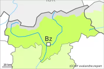
Danger level
 | treeline |
|  |
|  | ||||
| |
|  |


![]()
Fresh wind slabs are to be evaluated with care and prudence. Weakly bonded old snow above approximately 2200 m.
The fresh and older wind slabs are to be evaluated with care and prudence in all aspects above the tree line. These can be released by a single winter sport participant and reach medium size.
Weak layers in the old snowpack can be released even now by individual winter sport participants, especially on the Main Alpine Ridge and to the north. The avalanche prone locations are to be found in particular on steep, little used west, north and east facing slopes above approximately 2200 m and at transitions from a shallow to a deep snowpack. These places are rare but are difficult to recognise. Mostly avalanches are medium-sized.
Careful route selection is recommended.
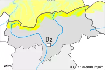
Snowpack
dp.6: cold, loose snow and wind
dp.1: deep persistent weak layer
5 to 15 cm of snow will fall on Sunday, in particular on the Main Alpine Ridge and to the north. As a consequence of new snow and a moderate to strong wind from variable directions, avalanche prone wind slabs will form in all aspects. In some cases the various wind slabs have bonded still only poorly with each other and the old snowpack. The snowpack will be subject to considerable local variations above the tree line.
Isolated avalanche prone weak layers exist in the centre of the snowpack in particular on very steep west, north and east facing slopes, especially between approximately 2200 and 2600 m.
Tendency
In some cases the various wind slabs have bonded still only poorly with each other and the old snowpack. The weather conditions will bring about a slow change towards better conditions.