AM
Danger level
 |
PM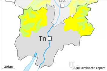
Danger level
 | 2800m |
|  |
|  |

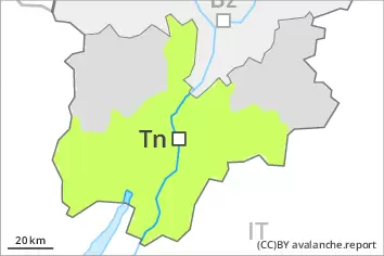
Significant warming at high altitude: Increase in danger of wet avalanches in the course of the day.
Late morning:
The mostly small wind slabs of the last few days can be released by a single winter sport participant in isolated cases on very steep shady slopes above approximately 2400 m.
Midday and afternoon:
As a consequence of warming during the day and the solar radiation, the likelihood of wet snow slides and avalanches being released will increase gradually. This applies in all aspects below approximately 2400 m, in particular on very steep east, south and west facing slopes below approximately 2800 m. Backcountry tours, off-piste skiing and ascents to alpine cabins should be concluded timely.
Snowpack
dp.10: springtime scenario
The surface of the snowpack is frozen, but not to a significant depth. Sunshine and high temperatures will give rise as the day progresses to rapid softening of the snowpack. The snowpack will become increasingly prone to triggering.
Faceted weak layers exist in the old snowpack, in particular on shady slopes above approximately 2200 m, as well as on east and west facing slopes above approximately 2400 m. The weather conditions will bring about a weakening of the weak layers as the day progresses.
The wind slabs of the last few days are in individual cases still prone to triggering on very steep shady slopes above approximately 2400 m.
Tendency
Tuesday: Wind and new snow. Fresh wind slabs require caution.