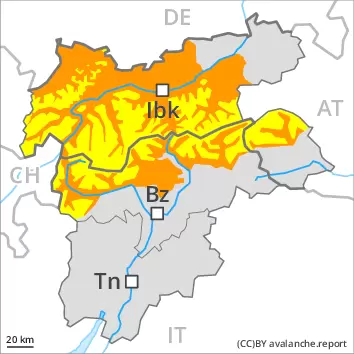
Considerable danger of wet avalanches will prevail. Weakly bonded old snow is to be evaluated with care and prudence.
As a consequence of warming more frequent wet avalanches are to be expected from the early morning. This applies in all aspects below approximately 2600 m. Wet avalanches can also release deeper layers of the snowpack and reach large size in isolated cases, especially on steep north facing slopes at high altitude. The runout zones of large avalanches are to be treated with caution.
In some places avalanches can be triggered in the weakly bonded old snow, in particular on very steep shady slopes above approximately 2600 m. Dry avalanches can in isolated cases penetrate deep layers and reach large size. As a consequence of warming, the likelihood of dry avalanches being released will increase. In addition the fresh wind slabs should be taken into account. Caution is to be exercised in particular adjacent to ridgelines at elevated altitudes.
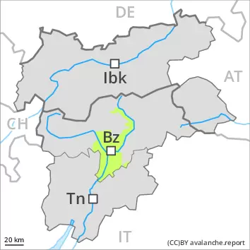
Snowpack
dp.10: springtime scenario dp.4: cold following warm / warm following cold
The rain gave rise on Friday to increasing and thorough wetting of the snowpack over a wide area. Outgoing longwave radiation during the night will be severely restricted. The surface of the snowpack will freeze very little and will soften quickly. The high temperatures will give rise to a loss of strength within the snowpack.
Avalanche prone weak layers exist in the top section of the snowpack in particular on steep shady slopes. The fresh wind slabs are in some cases prone to triggering at elevated altitudes.
Tendency
Slight decrease in danger of wet avalanches.
Danger level
Avalanche Problem
Wet snow
Moderate danger of wet avalanches will be encountered over a wide area.
As a consequence of warming more frequent wet avalanches are to be expected from the early morning, even medium-sized ones. The avalanche prone locations are to be found on steep slopes of all aspects. Wet avalanches can also release deeper layers of the snowpack, especially on steep north facing slopes at high altitude. The runout zones of avalanches are to be treated with caution.
Snowpack
dp.10: springtime scenario
The rain gave rise on Friday to increasing and thorough wetting of the snowpack over a wide area. Outgoing longwave radiation during the night will be reduced. The surface of the snowpack will freeze very little and will soften quickly. The high temperatures will give rise to a loss of strength within the snowpack.
Tendency
Moderate danger of wet avalanches will be encountered over a wide area.
Danger level
2200m
Avalanche Problem
Persistent weak layer
2200m
Wet snow
3200m
2200m
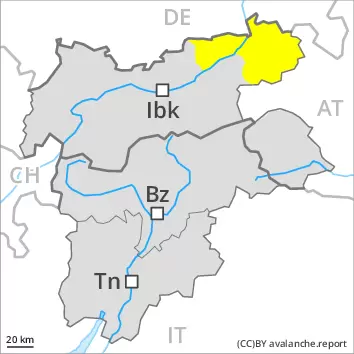
Weakly bonded old snow and wet snow require caution.
More recent wind slabs are to be assessed with care and prudence. The avalanche prone locations are sometimes covered with new snow and are difficult to recognise. Additionally in some places avalanches can also penetrate deep layers. Increase in danger of wet avalanches in the course of the day.
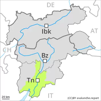
Snowpack
dp.10: springtime scenario
The Avalanche Warning Service currently has only a small amount of information that has been collected in the high Alpine regions, so that the avalanche danger should be investigated especially thoroughly in the relevant locality. Sunshine and high temperatures will give rise as the day progresses to moistening of the snowpack.
Tendency
Up to 2700 m rain will fall on Saturday in some regions. In addition the danger of dry and wet avalanches will increase on Sunday.
Danger level
Avalanche Problem
Wet snow
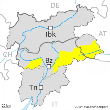
Wet snow represents the main danger.
As a consequence of warming wet avalanches are possible from the early morning, but they will be mostly small. The avalanche prone locations are to be found on steep slopes of all aspects. Apart from the danger of being buried, restraint should be exercised in particular in view of the danger of avalanches sweeping people along and giving rise to falls.
Snowpack
dp.10: springtime scenario
The rain gave rise on Friday to increasing and thorough wetting of the snowpack over a wide area. Outgoing longwave radiation during the night will be reduced. The surface of the snowpack will freeze very little and will soften quickly. The high temperatures will give rise to a loss of strength within the snowpack. At low and intermediate altitudes hardly any snow is lying.
Tendency
Gradual decrease in danger of wet avalanches as the temperature drops.
Danger level
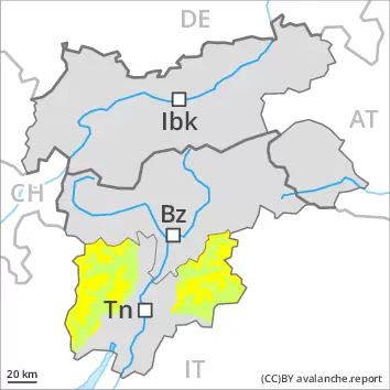
In all aspects a little snow is lying.
Increase in danger of wet snow slides as a consequence of warming during the day and solar radiation.
Snowpack
dp.10: springtime scenario
At low and intermediate altitudes from a snow sport perspective, in most cases insufficient snow is lying.
Tendency
Up to 2700 m rain will fall on Saturday in some regions.