Gliding avalanches are possible. Adjacent to ridgelines sometimes avalanche prone wind slabs will form.
From origins in starting zones where no previous releases have taken place more gliding avalanches are possible, even large ones in isolated cases. This applies on steep grassy slopes below approximately 2600 m. Caution is to be exercised in areas with glide cracks. As a consequence of the rain individual wet loose snow slides are possible.
Fresh wind slabs can be released by a single winter sport participant in some cases in particular on very steep shady slopes above approximately 2400 m. This applies in particular from the middle of the day. The prevalence of the avalanche prone locations will increase with altitude. They are barely recognisable because of the poor visibility. Especially slopes adjacent to ridgelines are unfavourable. Mostly avalanches are only small.
Snowpack
dp.2: gliding snow dp.6: cold, loose snow and wind
5 to 10 cm of snow will fall from midday above approximately 1800 m. The wind will be moderate adjacent to ridgelines. As a consequence of the northwesterly wind, fresh snow drift accumulations will form. These are lying on soft layers on wind-protected shady slopes above approximately 2400 m.
The snowpack will be wet all the way through below approximately 2000 m. At low altitude only a little snow is now lying.
Tendency
Gliding snow represents the main danger. The weather conditions will facilitate a gradual stabilisation of the snow drift accumulations. As a consequence of warming during the day and solar radiation mostly small wet loose snow avalanches are to be expected.
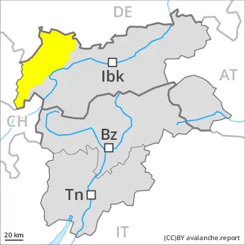
Danger level
2400m
Avalanche Problem
Wind slab
2400m
Gliding snow
2600m
Fresh wind slabs are in some cases prone to triggering. Gliding snow requires caution.
The fresh wind slabs can be released by a single winter sport participant in some cases in particular on very steep shady slopes above approximately 2400 m. This applies in particular from the middle of the day. The prevalence of the avalanche prone locations will increase with altitude. They are barely recognisable because of the poor visibility. Especially slopes adjacent to ridgelines are unfavourable. Avalanches can in very isolated cases reach medium size, in particular in the regions exposed to heavier precipitation.
On steep grassy slopes more gliding avalanches are possible, in particular medium-sized ones. This applies especially on steep sunny slopes below approximately 2600 m. Areas with glide cracks are to be avoided. As a consequence of the rain individual wet loose snow slides are possible.
Snowpack
dp.6: cold, loose snow and wind dp.2: gliding snow
5 to 15 cm of snow will fall from midday above approximately 1800 m. This applies in particular in the north. The wind will be moderate to strong in some regions. As a consequence of the northwesterly wind, fresh snow drift accumulations will form. These are lying on soft layers on wind-protected shady slopes above approximately 2400 m.
The snowpack will be wet all the way through below approximately 2000 m. At low altitude only a little snow is now lying.
Tendency
The conditions will facilitate a gradual stabilisation of the snow drift accumulations. As a consequence of warming during the day and solar radiation more frequent mostly small wet loose snow avalanches are to be expected. Gliding snow requires caution.
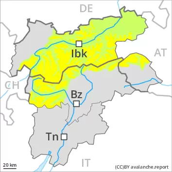
Danger level
2600m
Avalanche Problem
Wind slab
2600m
Wet snow
2600m
Wind slabs are in individual cases still prone to triggering. Wet and gliding snow require caution.
The fresh and older wind slabs can be released by a single winter sport participant in isolated cases in particular on very steep shady slopes above approximately 2600 m. Avalanches can in very isolated cases reach medium size. The prevalence of the avalanche prone locations will increase with altitude. Especially slopes adjacent to ridgelines are unfavourable. Avalanches can in very isolated cases be triggered in the old snowpack and reach quite a large size. Avalanche prone locations are to be found in particular on steep shady slopes above approximately 2600 m.
As a consequence of warming during the day and solar radiation more wet loose snow avalanches are to be expected as the day progresses. From origins in starting zones where no previous releases have taken place more gliding avalanches are possible, even medium-sized ones. This applies in particular on steep sunny slopes below approximately 2600 m. Caution is to be exercised in areas with glide cracks.
Snowpack
dp.6: cold, loose snow and wind dp.10: springtime scenario
Fresh and somewhat older wind slabs are lying on soft layers on wind-protected shady slopes above approximately 2600 m. Isolated avalanche prone weak layers exist in the centre of the snowpack in particular on west, north and east facing slopes.
Outgoing longwave radiation during the night will be quite good. The spring-like weather conditions as the day progresses will give rise to increasing moistening of the snowpack below approximately 2400 m. This also applies on steep sunny slopes at elevated altitudes.
Tendency
Some snow will fall in particular in the north. Wet loose snow avalanches are possible as the day progresses. Gliding avalanches can also occur.
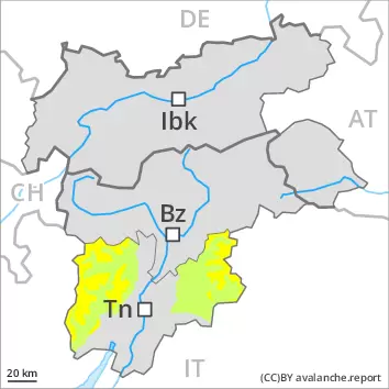
Danger level
2600m
Avalanche Problem
Gliding snow
2600m
Low avalanche danger will prevail. Gliding snow requires caution.
On steep grassy slopes more gliding avalanches are possible, even medium-sized ones. This applies in particular on steep sunny slopes below approximately 2600 m. Caution is to be exercised in areas with glide cracks.
Wind slabs can be released in isolated cases, but mostly only by large additional loads, on extremely steep shady slopes above approximately 2600 m. Caution is to be exercised adjacent to ridgelines.
Snowpack
dp.2: gliding snow
Wind slabs have bonded well with the old snowpack. They are only small and unlikely to be released now. In particular below approximately 2200 m: The snowpack is wet and its surface has a crust. At low and intermediate altitudes only a little snow is now lying.
Tendency
Individual wet loose snow avalanches are possible as the day progresses. Gliding avalanches can also occur.
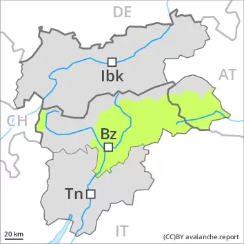
Danger level
2600m
Avalanche Problem
Wet snow
2600m
Gliding snow
2600m
Wet and gliding snow require caution.
As a consequence of warming during the day and solar radiation more wet loose snow avalanches are possible, but they will be mostly small. On steep grassy slopes more gliding avalanches are possible, even medium-sized ones. This applies in particular on steep sunny slopes below approximately 2600 m. Caution is to be exercised in areas with glide cracks.
Wind slabs can be released in isolated cases, but mostly only by large additional loads, on extremely steep shady slopes above approximately 2600 m. Caution is to be exercised adjacent to ridgelines.
Snowpack
dp.10: springtime scenario dp.2: gliding snow
Outgoing longwave radiation during the night will be quite good. The spring-like weather conditions as the day progresses will give rise to increasing moistening of the snowpack below approximately 2400 m. This also applies on steep sunny slopes at elevated altitudes.
Wind slabs have bonded well with the old snowpack. They are only small and unlikely to be released now. At low and intermediate altitudes only a little snow is now lying.
Tendency
Individual wet loose snow avalanches are possible as the day progresses. Gliding avalanches can also occur.