As a consequence of heat and rain an unfavourable avalanche situation will prevail.
From the late morning as a consequence of the rain there will be a rapid increase in the danger of wet avalanches. As the penetration by moisture increases medium-sized and, in isolated cases, large wet and gliding avalanches are possible. This applies in all aspects especially below approximately 2400 m. Especially west, north and east facing slopes are unfavourable.
As a consequence of new snow and a moderate to strong northwesterly wind, mostly small wind slabs will form in high Alpine regions. The fresh wind slabs can be released by a single winter sport participant in isolated cases in particular on very steep shady slopes. They are barely recognisable because of the poor visibility.
Snowpack
dp.3: rain dp.2: gliding snow
5 to 10 cm of snow, and even more in some localities, will fall above approximately 2400 m. The rain will give rise as the day progresses to a loss of strength within the snowpack below approximately 2400 m.
The wind will be moderate to strong. The fresh wind slabs are bonding well with the old snowpack. They are mostly small and can only be released in isolated cases.
Tendency
The surface of the snowpack will cool hardly at all during the overcast night and will already be soft in the early morning. Wet and gliding avalanches are possible from the early morning, even quite large ones.
Danger level
2400m
Avalanche Problem
Wet snow
2400m
Gliding snow
2600m
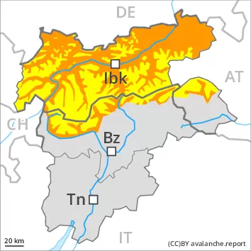
Increase in danger of wet avalanches as a consequence of the rain. Gliding snow requires caution.
From midday as a consequence of the rain there will be a rapid increase in the danger of wet avalanches. Individual medium-sized wet and gliding avalanches are possible. This applies in all aspects especially below approximately 2400 m. Especially west, north and east facing slopes are unfavourable. The danger is within the upper range of danger level 2 (moderate).
Snowpack
dp.3: rain dp.2: gliding snow
Outgoing longwave radiation during the night will be reduced. The surface of the snowpack is frozen, but not to a significant depth and will soften earlier than the day before. Up to 2400 m rain will fall from the afternoon. The spring-like weather conditions as the day progresses will give rise to increasing and thorough wetting of the snowpack.
Tendency
The surface of the snowpack will only just freeze and will soften quickly. Wet and gliding avalanches are possible from the early morning.
Danger level
2600m
Avalanche Problem
Wind slab
2600m
Wet snow
2600m
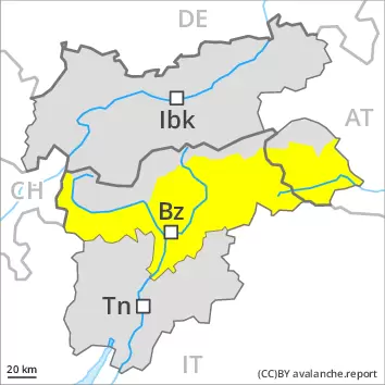
Wind slabs are in some cases still prone to triggering above approximately 2600 m. Wet and gliding snow require caution.
The deep wind slabs can be released by a single winter sport participant in isolated cases in particular on very steep shady slopes above approximately 2600 m. Avalanches can in very isolated cases reach medium size. Avalanches can in very isolated cases be triggered in the old snowpack and reach quite a large size. Avalanche prone locations are to be found in particular on steep shady slopes above approximately 2600 m. As a consequence of warming more wet loose snow avalanches are possible at any time, even medium-sized ones. This applies in particular on steep slopes below approximately 2600 m. Caution is to be exercised in areas with glide cracks.
Snowpack
dp.10: springtime scenario
The wind slabs are lying on soft layers on wind-protected shady slopes above approximately 2600 m. Outgoing longwave radiation during the night will be reduced in some places. The spring-like weather conditions will give rise to thorough wetting of the snowpack below approximately 2600 m. Isolated avalanche prone weak layers exist in the centre of the snowpack in particular on west, north and east facing slopes. At low altitude only a little snow is lying. In some localities 2 to 5 cm of snow will fall above approximately 2200 m. The wind will be moderate to strong at times over a wide area.
Tendency
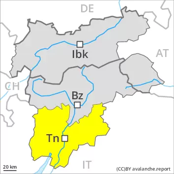
On Friday it will be mild over a wide area. Sunshine and high temperatures will give rise as the day progresses to softening of the snowpack in particular on sunny slopes.