The danger of wet avalanches will already increase in the late morning.
As a consequence of warming during the day and the solar radiation, the likelihood of wet avalanches being released will increase quickly. This applies on steep sunny slopes in all altitude zones, as well as on steep, rather lightly snow-covered shady slopes below approximately 2600 m. On steep grassy slopes more medium-sized and, in isolated cases, large gliding avalanches are possible below approximately 2600 m. Areas with glide cracks are to be avoided.
In isolated cases wet avalanches can also release the saturated snowpack and reach large size. In steep gullies the avalanches can in isolated cases reach valley bottoms at relatively high altitudes. Backcountry tours and ascents to alpine cabins should be started and concluded very early.
Snowpack
dp.10: springtime scenario dp.2: gliding snow
The weather will be very warm. The surface of the snowpack will freeze to form a strong crust only at high altitudes and will already soften in the late morning. Sunshine and high temperatures will give rise from late morning to a loss of strength within the snowpack. In areas with a thinner snowpack the saturation and consequently the loss of strength happens more rapidly The snowpack will be wet all the way through below approximately 2400 m. Hardly any snow is lying at low and intermediate altitudes.
Tendency
The weather will be exceptionally warm. The summery weather conditions will give rise to rapid and thorough wetting of the snowpack at elevated altitudes.
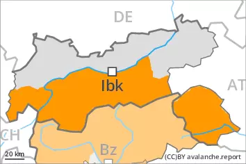
EARLIER Danger level
Avalanche Problem
Gliding snow
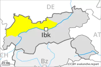
LATER Danger level
Avalanche Problem
Gliding snow
Wet snow
Wet and gliding avalanches are the main danger.
As a consequence of warming during the day and the solar radiation, the likelihood of wet avalanches being released will increase quickly. Avalanche prone locations are to be found on very steep slopes in all altitude zones. In some cases avalanches are medium-sized. On steep grassy slopes more medium-sized gliding avalanches are possible. Areas with glide cracks are to be avoided.
In steep gullies the avalanches can in very isolated cases reach areas without any snow cover.
Snowpack
dp.10: springtime scenario dp.2: gliding snow
The weather will be very warm. The surface of the snowpack will freeze to form a strong crust only at high altitudes and will already soften in the late morning. Sunshine and high temperatures will give rise from late morning to a loss of strength within the snowpack. The snowpack will be wet all the way through over a wide area. Hardly any snow is lying at low and intermediate altitudes.
Tendency
The weather will be exceptionally warm. The summery weather conditions will give rise to rapid and thorough wetting of the snowpack at elevated altitudes.
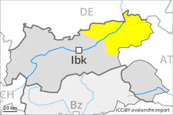
EARLIER Danger level
2600m
Avalanche Problem
Gliding snow
2600m
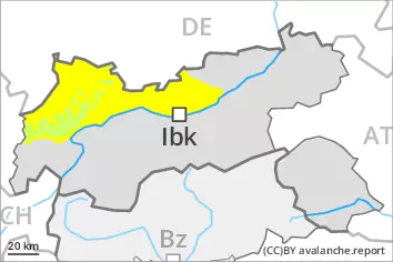
LATER Danger level
2600m
Avalanche Problem
Gliding snow
2600m
Wet snow
Wet and gliding avalanches are the main danger.
As a consequence of warming during the day and the solar radiation, the likelihood of wet avalanches being released will increase quickly. This applies on steep sunny slopes in all altitude zones, as well as on steep, rather lightly snow-covered shady slopes below approximately 2600 m. Mostly avalanches are medium-sized. On steep grassy slopes more medium-sized and, in isolated cases, large gliding avalanches are possible below approximately 2600 m. Areas with glide cracks are to be avoided.
In very isolated cases wet avalanches can also release the saturated snowpack and reach large size. In steep gullies the avalanches can in isolated cases reach areas without any snow cover. Backcountry tours and ascents to alpine cabins should be started and concluded very early.
Snowpack
dp.10: springtime scenario dp.2: gliding snow
The weather will be very warm. The surface of the snowpack will freeze to form a strong crust only at high altitudes and will already soften in the late morning. Sunshine and high temperatures will give rise from late morning to a loss of strength within the snowpack. In areas with a thinner snowpack the saturation and consequently the loss of strength happens more rapidly The snowpack will be wet all the way through below approximately 2400 m. Hardly any snow is lying at low and intermediate altitudes.
Tendency
The weather will be exceptionally warm. The summery weather conditions will give rise to rapid and thorough wetting of the snowpack at elevated altitudes.