Increase in avalanche danger as a consequence of the precipitation.
The new snow and wind slabs of the last few days must be evaluated with care and prudence in all aspects above approximately 2500 m. Dry avalanches can reach medium size in particular in the regions exposed to heavier precipitation, especially on wind-loaded slopes. These can in some places be released by small loads. The avalanche prone locations are to be found in particular on steep slopes above approximately 2500 m. As a consequence of the rain wet and gliding avalanches are possible as the day progresses, especially on steep slopes below approximately 2500 m in all aspects.
Snowpack
In some regions up to 30 cm of snow, and even more in some localities, has fallen above approximately 2500 m. As a consequence of new snow and a sometimes strong wind, sometimes avalanche prone wind slabs formed in particular in the vicinity of peaks. The rain gave rise to increasing and thorough wetting of the snowpack below approximately 2300 m.
Tendency
The avalanche danger will increase but remain within the current danger level. Fresh wind slabs represent the main danger. As a consequence of warming loose snow avalanches are to be expected, even medium-sized ones, especially in steep rocky terrain in all aspects below approximately 2500 m.
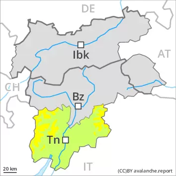
Danger level
2600m
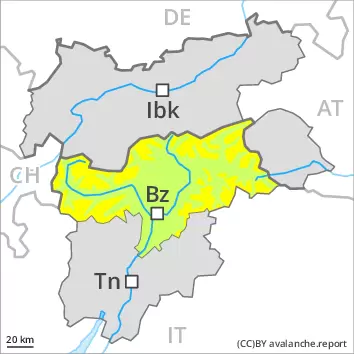
Avalanche Problem
Wind slab
2600m
Fresh wind slabs are to be evaluated with care and prudence.
High altitudes and the high Alpine regions: The fresh wind slabs are in isolated cases prone to triggering on west to north to east facing aspects. Avalanches can reach medium size in particular in the regions exposed to heavier precipitation.
Only isolated wet and gliding avalanches are possible. In very isolated cases avalanches can release the saturated snowpack and reach a dangerous size.
The Avalanche Warning Service currently has only a small amount of information that has been collected in the field, so that the avalanche danger should be investigated especially thoroughly in the relevant locality.
Snowpack
dp.6: cold, loose snow and wind
High altitudes and the high Alpine regions: Some snow will fall in some localities. In some localities up to 15 cm of snow, and even more in some localities, has fallen. As a consequence of a sometimes strong wind from variable directions, wind slabs will form in particular in gullies and bowls and behind abrupt changes in the terrain.
Tendency
Fresh wind slabs require caution. Regions exposed to heavier precipitation: As a consequence of warming during the day and solar radiation more frequent loose snow avalanches are to be expected as the day progresses, even medium-sized ones, especially in steep rocky terrain in all aspects.