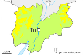
Danger level
 | 2600m |
|  |
|  | ||||
|  |
|  |

In the last few days wind slabs formed in high Alpine regions. They represent the main danger. Below approximately 2600 m mostly small moist loose snow slides are possible.
The new snow and wind slabs of the last few days must be evaluated with care and prudence in all aspects above approximately 2600 m. Avalanches can reach medium size. These can in some places be released by small loads, especially adjacent to ridgelines and in gullies and bowls.
As a consequence of warming during the day and solar radiation wet and gliding avalanches are possible as the day progresses, especially on steep slopes below approximately 2600 m in all aspects.
Snowpack
dp.6: cold, loose snow and wind
dp.10: springtime scenario
As a consequence of southeasterly wind, wind slabs formed in the last few days in high Alpine regions. Sunshine and high temperatures will give rise as the day progresses to gradual and thorough wetting of the snowpack.
Tendency
As a consequence of warming loose snow avalanches are to be expected as the day progresses, especially in steep rocky terrain in all aspects.

