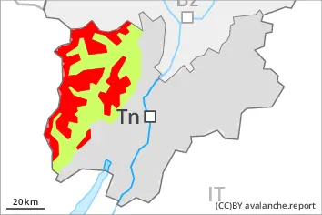
New snow and wind slabs above approximately 1800 m. In addition the sometimes large wind slabs of the last two days at high altitudes and in high Alpine regions are capable of being triggered. Weak layers exist in the old snowpack in particular on steep shady slopes.
As a consequence of new snow and a strong to storm force wind, sometimes easily released wind slabs formed in particular adjacent to ridgelines and in gullies and bowls. The avalanche danger is close to the boundary with danger level 4 (high). On steep slopes and in gullies and bowls, and behind abrupt changes in the terrain slab avalanches are possible, even large ones.
Snowpack
dp.6: cold, loose snow and wind dp.1: deep persistent weak layer
Over a wide area over a wide area 30 to 70 cm of snow, and even more in some localities, has fallen since Monday above approximately 1800 m. The snowpack will become in most cases subject to considerable local variations. The various wind slabs have bonded poorly with the old snowpack. The rain gave rise to thorough wetting of the snowpack over a wide area below approximately 1700 m.
Tendency
Thursday: The avalanche danger will decrease.
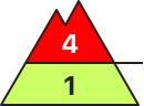
Danger level
treeline
Avalanche Problem
New snow
Treeline
Wind slab
Treeline
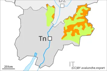
New snow and wind slabs above approximately 1800 m. In addition the wind slabs in gullies and bowls, and behind abrupt changes in the terrain are capable of being triggered. Weak layers exist in the old snowpack in particular on steep shady slopes.
As a consequence of new snow and a moderate to strong wind, sometimes easily released wind slabs formed in particular adjacent to ridgelines and in gullies and bowls. On steep shady slopes and in gullies and bowls, and behind abrupt changes in the terrain slab avalanches are possible, even large ones.
Snowpack
dp.6: cold, loose snow and wind dp.1: deep persistent weak layer
Over a wide area over a wide area 20 to 40 cm of snow, and even more in some localities, has fallen above approximately 2000 m. The snowpack will become in most cases subject to considerable local variations. The various wind slabs have bonded poorly with the old snowpack. The rain gave rise to thorough wetting of the snowpack over a wide area below approximately 1900 m.
Tendency
Thursday: The avalanche danger will persist.
Danger level
treeline
Avalanche Problem
Persistent weak layer
Treeline
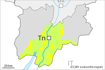
Dry and moist avalanches require caution.
Avalanche prone locations for dry avalanches are to be found in particular on steep slopes at high altitude, also on steep shady slopes in areas close to the tree line. The various wind slabs have bonded poorly with the old snowpack. The avalanche prone locations are clearly recognisable to the trained eye.
Snowpack
The rain gave rise on Tuesday to thorough wetting of the snowpack below approximately 2000 m. As a consequence of falling temperatures a crust formed on the surface during the night. The rain gave rise to thorough wetting of the snowpack over a wide area below approximately 1900 m. Over a wide area new snow is lying on a wet snowpack. The snow sport conditions outside marked and open pistes are to some extent precarious.