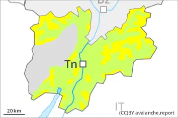
Danger level
 | treeline |
|  |
|  | ||||
|  |
| |


![]()
New snow and wind slabs represent the main danger.
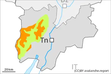
Individual mostly small moist and wet avalanches are possible.
Over a wide area 10 to 20 cm of snow has fallen above approximately 1700 m.
Up to 10 cm of snow, and even more in some localities, will fall until Thursday above approximately 1700 m. The avalanche danger will increase but remain within the current danger level.
The wind slabs must be evaluated with care and prudence in all aspects above the tree line. The avalanche prone locations are to be found in particular adjacent to ridgelines and in gullies and bowls, and behind abrupt changes in the terrain.
As a consequence of warming during the day individual small to medium-sized moist and wet avalanches are possible.
Snowpack
dp.6: cold, loose snow and wind
dp.10: springtime scenario
Over a wide area up to 20 cm of snow will fall above approximately 1800 m. The wind will transport the new snow. The more recent wind slabs are bonding poorly with the old snowpack in all aspects at intermediate and high altitudes.
Below approximately 1800 m only a small amount of snow is lying for the time of year.
Tendency
The avalanche danger will persist.